NASA scientists get first rover's-eye view of Gale Crater on Mars
Loading...
NASA's Mars rover Curiosity has phoned home, told its handlers all is well, and provided researchers with their first look at some of the rover's surroundings.
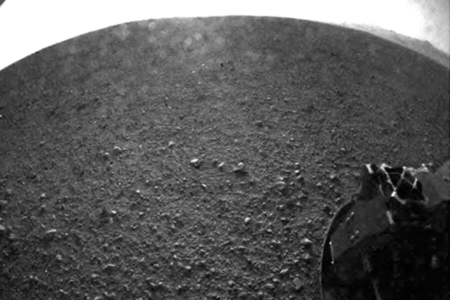
As of Monday morning, Curiosity has sent along only seven small images, taken with the four pairs of hazard-avoidance cameras mounted on the front and rear of the rover's chassis.
Their fish-eye views of the surface, processed to look like normal photos, have given the science and engineering teams their first on-the-ground look at the rim of Gale Crater some 12 miles away, as well as the fuzzy profile of Mt. Sharp, the three-mile-high mountain in the crater's center, and dune fields a mile or two away. Beyond the dune fields, the region of the mountain's base that the science team would like to explore is about six miles from the rover.
Mt. Sharp is Curiosity's ultimate destination as it hunts for signs that, at some point early in the planet's history, Gale Crater might have sported habitats suitable for sustaining life.
In addition, NASA's Mars Reconnaissance Orbiter (MRO) snapped a "Welcome to Mars" image of the rover and its descent module, suspended from a 70-foot-wide parachute that helped slow the craft as it headed toward the surface.
The orbiter has taken more than 120 images of Gale Crater, images that played a key role in the site's selection as Curiosity's new home.
But the shot of Curiosity hanging from its 'chute "is the coolest one," says Sarah Milkovich, a researcher at NASA's Jet Propulsion Laboratory (JPL) in Pasadena, Calif., and a member of the science team using MRO's HiRISE camera to study the Martian surface. HiRISE captured Curiosity's descent from a respectful distance of nearly 215 miles.
The rover's unique descent system – a descent stage that used automated navigation and steering jets to slalom its way through the upper atmosphere as well as the sky-crane system to lower Curiosity the final few tens of feet to the surface – deposited the rover within a mile of its expected landing point. The rover's landing spot remained well within a 12-mile by 4-mile elliptical landing zone near the base of Mt. Sharp.
"We haven't been able to get our simulations to work that well," says Miguel San Martin, chief engineer for guidance navigation and control at JPL.
Indeed, such a precision landing – in this case setting a craft down in a narrow region between a towering mountain and the inner walls of a crater's rim – has never been achieved before, noted John Grotzinger, a planetary scientist at the California Institute of Technology in Pasadena, Calif., and the project scientist for the mission, during a briefing Monday.
For the first time, scientists were able to select a target for study purely on scientific grounds, he says, and not as a compromise between science and engineers' need to safely land a rover on the Martian equivalent of the Great Plains.
Oriented in a way that pointed one set of "hazcams" at the crater rim and the other at the imposing summit in the crater's center, the rover presented mission planners with a conundrum: Which set of cameras, fore or aft, did the scientists want to use first if time allowed for an initial photo to be taken and uplinked before orbiters acting as relay stations dipped below the horizon?
"All of the scientists wanted the rear hazcam," Dr. Grotzinger says. "And all of the engineers wanted the front hazcam."
The engineers were looking for the camera that would give the scientists the best view of the landscape, unobstructed by bits of the rover falling into the camera's field of view. Views from the rear cameras were partially obstructed by the rover's wheels.
"We said: No, we want to see the wheels on the ground, because this is not a moment for science, it's a moment for engineering," Grotzinger continued. "When you see that wheel on the ground, you know you've landed on Mars. That is the miracle of engineering."


