Earthquakes: Why ground under Los Angeles could make big one even bigger
Loading...
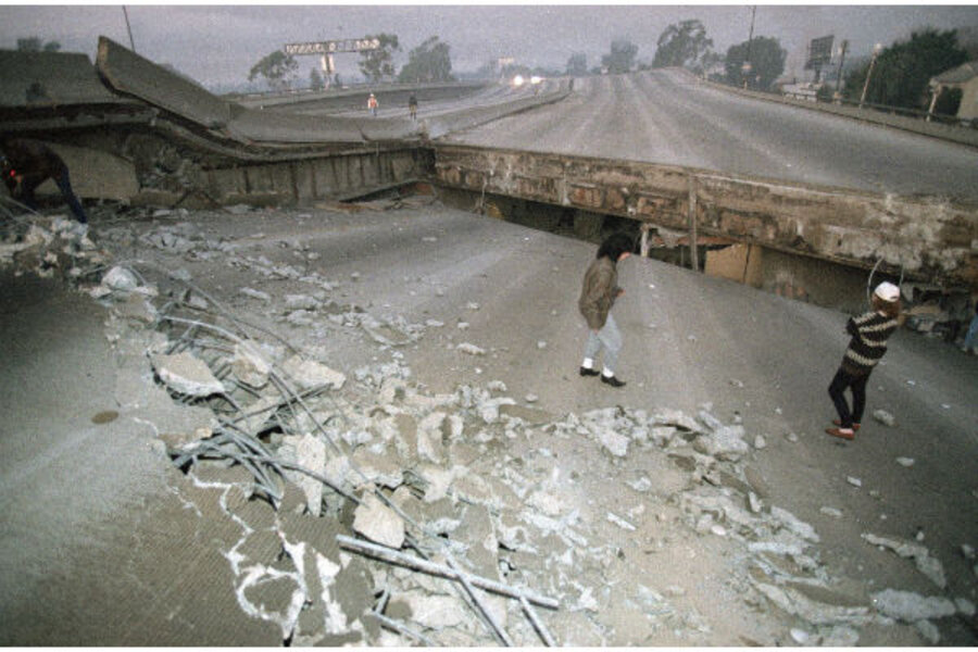
Twenty years ago last week, a massive earthquake measuring 7.3 on the Richter scale rocked the Los Angeles area, killing 57 people and wreaking $40 billion in damage on southern California. But if the southern San Andreas fault were to rupture in a certain way, seismologists expect that an even bigger quake, with a magnitude not seen in that area in more than 300 years, could be on the horizon.
In hopes of better informing engineers that design buildings in the area, the National Science Foundation has invested millions of dollars in a supercomputer designed to simulate how such a quake might travel from the fault line through the city. Such a rupture, computer models suggest, could reverberate through the Los Angeles area and cause much stronger ground motion than previously expected.
Until recently, seismologists had no way of testing those predictions. But a new technique developed by Marine Denolle at Stanford University in Stanford, Calif. puts those computer-generated simulations to the test. Her findings were published Thursday in the journal Science.
By placing sensors along the fault line, Dr. Denolle and her fellow researchers have been able to study how ambient noise, such as vibrations created by ocean waves, transmits through the ground. The team then extrapolated the data collected from that ambient noise to create a “virtual earthquake.”
By synthesizing information gathered from that ambient noise, Denolle’s team has been able to “simulate what would happen if you actually had a big earthquake propogating up the San Andreas Fault ... not from any models, but from the real data coming out of the earth,” says Thomas Jordan, director of the Southern California Earthquake Center, which sponsored part of Denolle’s research. “It’s a way of tricking the earth to giving us its response to a large earthquake.”
These virtual earthquakes confirm that the geological structure underneath Los Angeles actually amplifies the shock waves of a quake, meaning that Angelenos could feel shaking “as strong as being next to the fault,” even 100 miles away from the actual rupture.
Typically, earthquakes produce seismic waves that dissipate as they radiate away from the source. However, Los Angeles, and many other major cities around the world, sits atop a complex geological structure known as a sedimentary basin that alters the way energy transfers through the ground.
A sedimentary basin is formed when the shifting of tectonic plates leave large holes in the substrate underneath the earth’s surface. As wind and rain invade nearby mountains over hundreds of thousands of years, small pieces of rock break off and travel along nearby rivers into the open hole. The result is “a hole within very stiff rock within which you have very fine grain rocks that we call sediments,” Denolle explains.
Cities often spring up around these basins because people rely on those same rivers that carried the sediment into the basin for navigation and irrigation. Paris, Caracas, Bogota, Mexico City, and Tokyo are all built atop similar sedimentary basins.
Denolle believes that this same technique will prove useful for other cities around the world.
While seismologists in Los Angeles are using Denolle’s virtual earthquakes to supplement extensive research that has taken place over several decades, scientists in other cities may not have such robust data to draw from.
“I think this experiment could be done anywhere on Earth,” she says. “This is complementary to big simulations that require a lot of taxpayers money, but it could also be done in countries that do not have super computers. For developing countries, I think it’s a hope for something a bit more sustainable.”
Denolle’s technique could prove useful for other areas of the United States as well. While most Americans think of California when they hear earthquake, tremors can occur in other areas of the nation, as Pennsylvanians and Ohioans learned last year when a 4.0 quake rattled residents. Another mild tremor measuring 1.8 made headlines in parts of Pennsylvania earlier this month.
Some seismologists have speculated that these minor tremors could actually be aftershocks of a devastating sequence of shocks nearing a magnitude of 8 that ripped through the central US in 1811 and 1812, and that the earthquake cycle in the area has actually ended.
New research, also published Thursday in Science, from the US Geological Survey in Pasadena challenges that theory and surmises that plates in the region, known as the New Madrid Seismic Zone, may still be experiencing strain and should be considered an existing earthquake hazard.
An earthquake even approaching the magnitude of the 1811 and 1812 shocks could devastate urban areas in the Midwest and eastern United States where building codes typically do not factor in susceptibility to quakes.
As on the West Coast, many urban areas in the New Madrid are situated atop sedimentary basins and could be subject to the same seismic amplification that is predicted in Los Angeles. Denolle’s virtual earthquakes could be “potentially very useful in terms of mapping out areas where the ground shaking might be amplified because of the subsurface geology but likewise areas that the shaking wouldn’t be as strong,” says Robert Graves, a research geophysicist at the US Geological Survey in Pasadena, Calif. He was not involved in this New Madrid study but has conducted his own research in the area.


