Experimental geography as art
Loading...
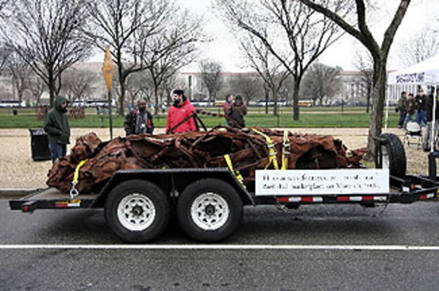
Since February, this strange caravan has been wending its way across the continental United States: a 39-foot RV; the gnarled carcass of a car destroyed two years ago in a suicide bombing in downtown Baghdad; and a rotating cast of artists, soldiers, and journalists, including an Iraqi national named Esam Pasha, and Jonathan Harvey, an American who fought in the Iraq war.
"It Is What It Is" was created by British artist Jeremy Deller to stimulate conversation about the conflict overseas. In cities from Santa Fe to Cincinnati, the participants disembark and invite ordinary Americans to speak their mind on issues political and personal. The car – ravaged and rusted – serves as a centerpiece: a steel-cast stand-in for the 38 Iraqis killed in the 2007 attack.
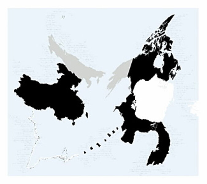
But for Nato Thompson, who is helping to curate the show on behalf of New York's New Museum and the nonprofit group Creative Time, the exhibition is more than a simple forum. It is also an integral addition to an emergent art form known as "experimental geography," which mashes the academic rigor of traditional geography with politics and the principles of modern multimedia and performance art.
"I like to think of us as creating a kind of space for dialogue, and for analysis, and for interaction," the high-spirited Mr. Thompson said in a phone interview from Houston, where Mr. Deller and the other participants were slated to give a talk at the Glassell School of Art. "We're tracking our progress on a map on a website, for instance [conversationsaboutiraq.org], and updating video and blog posts, and inviting people to think not just about the physical landscape, but our cultural landscape, too."
Over the past few months, innovative projects such as "It Is What It Is" have gained a good deal of ballast, both with art world vets and a fresh wave of local activists and artists. Experimental geography was the topic of a sold-out discussion at the New Museum here, and the theme of a traveling show presented by Independent Curators International, a New York-based arts organization. And "Experimental Geography" is the title of a popular accompanying catalog, copublished by iCI and Brooklyn's Melville House and edited by Thompson.
"The fact that it's been sort of a hybrid medium, that it's incorporated cartography, and art, and political activism, and geography – well, that's very exciting," says Susan Hapgood, the director of exhibitions at iCI. "There has been an overwhelming amount of interest in the show. The phone has not stopped ringing." (From June 28 to Sept. 20, "Experimental Geography" will be at The Albuquerque Museum of Art and History, in New Mexico.)
Coined by the geographer and artist Trevor Paglen, the term "experimental geography" has been interpreted in myriad ways, and all of its adherents have a slightly different take on its meaning. It can incorporate aspects of cartography, of printmaking, of activism, and even of theater. "When I first started doing this stuff, I aimed it mostly at geographers and academics," Mr. Paglen says. "This new audience is not originally what I had in mind, and as a result, I don't have an Oprah's-couch answer to [what experimental geography] is. It's an abstract idea, and necessarily so – it has to operate at a certain level of abstraction."
To look at it another way, experimental geography is a broad and varied science. Experimental geography was an important part of a recent performance of "Waiting for Godot," in the ruins of the Lower Ninth Ward, in New Orleans; it was also one of the central principles of Paglen's recent book, "Blank Spots on a Map," which explored the landscape and iconography of America's secret military prisons and airstrips. And then there was the piece created by the artist kanarinka, who jogged Boston's entire evacuation route.
With the help of a handful of gadgets, kanarinka measured the exact number of breaths – over 26 runs and a hundred-plus miles – that it took her to get out of the city. (Answer: 154,000.) She mapped her progress on a personal website, eventually emerging with a multidimensional map – one that measured both physical geography and her emotional response to the prospect of another terrorist attack on US soil.
At heart, Thompson has written, experimental geography is rooted in the idea that "we make the world, and in turn, the world makes us. This insight brings into relief an intimate relationship between what we consider culture and the spaces around us." As Thompson goes on to acknowledge, experimental geography has its basis in the work of the Situationists, who believed that our interactions with the landscape are vital to the way in which we see ourselves.
But experimental geography is especially influenced by the rise in social networking and widespread – and cheap – mapping capability, from Google Maps to the Global Positioning System. "You've got all these new tools out there," says Jeffrey Kastner, a longtime arts journalist and a contributor to "Experimental Geography." "There's all this spreading and melting going on – people thinking about political space, physical space, and social space. Something as simple as being on the Web helps test the boundaries we used to take for granted, and … question these longstanding notions of how the world is divided up."
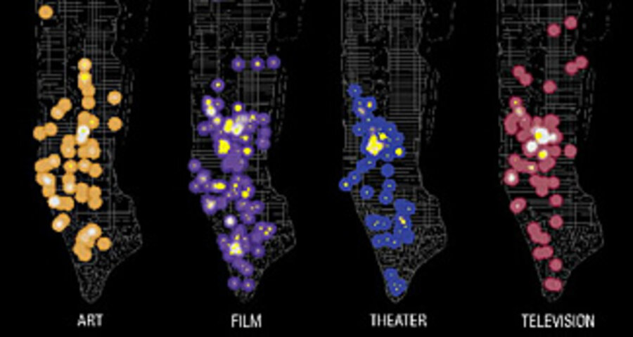
This last concept – the ephemeral nature of today's digitalized landscape – is being explored in a new study and exhibit called "The Geography of Buzz," now showing at Studio-X, an arts space affiliated with Columbia University. The authors, Elizabeth Currid and Sarah Williams, are both academics; Ms. Currid is an assistant professor at the University of Southern California, and Ms. Williams is the director of Columbia's Spatial Information Design Lab. Three years ago, the two began to dig through photographs of Los Angeles and New York compiled by Getty Images, the stock photography service.
They were looking to "ground" the concept of "buzz," that all-important barometer of which areas of a city are cool and which aren't. Although Currid and Williams don't explicitly identify themselves as experimental geographers, their project bears much in common with the work featured in iCI's traveling show – it seeks to aestheticize a large quantity of data and to draw connections between humans and their environs. In this case, a series of maps chart hot spots in Los Angeles and New York City over a three-year period. The maps are black; the "buzz" is realized in splashes of bright color.
"To be able to expose an issue, and relate it back to physical space – that resonates with people," says Williams. "Just like putting data on a map makes things more real to people. I think we'll see a lot more of these explorations between art and sociological or political projects." Adds Currid: "A sense of place has always been fundamental to everything that happens in the world. And all this new technology only highlights that idea: geography is basic to the way we live."


