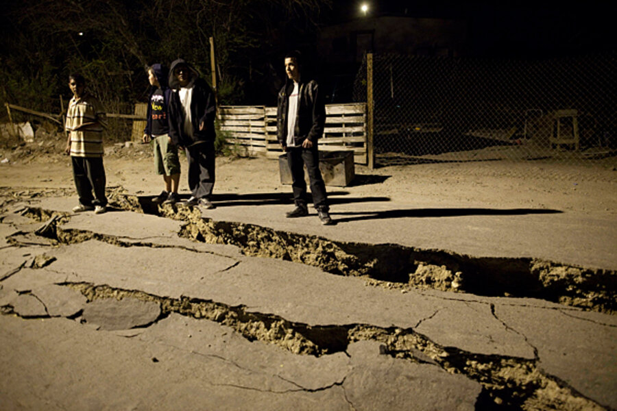
Study: Baja earthquake sign of a bigger one to come?
When an earthquake fault ruptured in Baja California last Easter Sunday, seismologists knew first and foremost that it was a big one. At magnitude 7.2, it was the most powerful quake on the fault in 120 years.
After months of study, however, seismologists say the quake has become one for the text books.
Not only has it displayed highly unusual traits in its own right, it has revealed the existence of several previously unknown faults on both sides of the California-Mexico border.
And it has triggered movement on several faults in southern California, including three of the region's mightiest: the San Andreas, San Jacinto, and Elsinore faults.
One experimental model run at NASA's Jet Propulsion Laboratory in Pasadena, Calif., suggests that if the past 100,000 years of seismic history in California is any guide, the Baja quake may have shifted stress patterns along faults to the north in ways that could touch off a large quake on one of the Big Three within three to 30 years.
Indeed, the research team conducting the study notes that the shift in strain in the Earth's crust after the Baja quake may have touched off a magnitude 5.4 earthquake in July on the San Jacinto fault at Collins Valley, west of the Salton Sea.
"This earthquake was a special event," said John Fletcher, a seismologist at the Center for Scientific Research and Higher Education in Ensenada, Mexico, on Baja California's west coast.
The fault in question, the Laguna Salada, is part of a series of generally northwest trending faults that mark the boundary between the Pacific and North American plates, two large segments of Earth's crust. The various faults along the boundary run up the Gulf of California, then pass through the Colorado River Delta to crease and crinkle the Earth's surface inland of the California coast. A drive from Los Angeles east to Barstow, in the Mojave Desert, spans 115 miles and bridges the two plates.
During the April quake, "the surface rupture did something very weird," Dr. Fletcher said in a briefing describing what scientists have learned about the event.
"It dropped the high mountains of the Sierra Cucapah down. I can't name another example where a surface rupture is acutally lowering the local high topography."
The fault runs along the length of the Sierra Cucupah mountains.
In addition, as the rupture traveled up the northern segment of the fault, it in effect hit a geological brick wall, forcing the rupture to travel back toward the quake's epicenter.
The rupture, which affected the full length of the surface fault from the northern tip of the Gulf of California to the California-Mexico border, also managed to leapfrog a gap in the fault that is twice as long as any previously observed seismic long-jump, Fletcher said.
For a zoomable map of California's active faults, click here.
Scientists involved in the effort credit data from a pair of remote-sensing tools – space-based and aircraft-based radar and LIDAR, a form of radar that uses laser light rather than radio waves – with helping them uncover the effects of the quake and its aftermath.
These tools map changes in surface height and detect ground movement in such detail that field geologists using the data as guidance were able to reach and verify the faults involved and locate previously unknown faults the shaking revealed far more efficiently than in the past.
The techniques also uncovered evidence for a deep fault with no obvious surface features that appears to link the north end of the Laguna Salada fault with the southern end of the Elsinore fault. From a hazard standpoint, that's troubling news, researchers say, because it suggests that the fault system may be capable of larger earthquakes than previously thought.
The briefing on the April 2010 quake came two days after the Federal Emergency Management Agency and the State of California signed off on a comprehensive plan for responding to a major quake in southern California.
The encouraging news for efforts to improve earthquake hazard estimates: The Easter Sunday quake has highlighted the value of the high-tech tools the team could bring to bear in studying the quake.
"The major earthquake in Baja last April is providing direct evidence that time-critical monitoring of hazardous faults is possible," says Eric Fielding, a geophysicst at JPL who also took part in the study.


