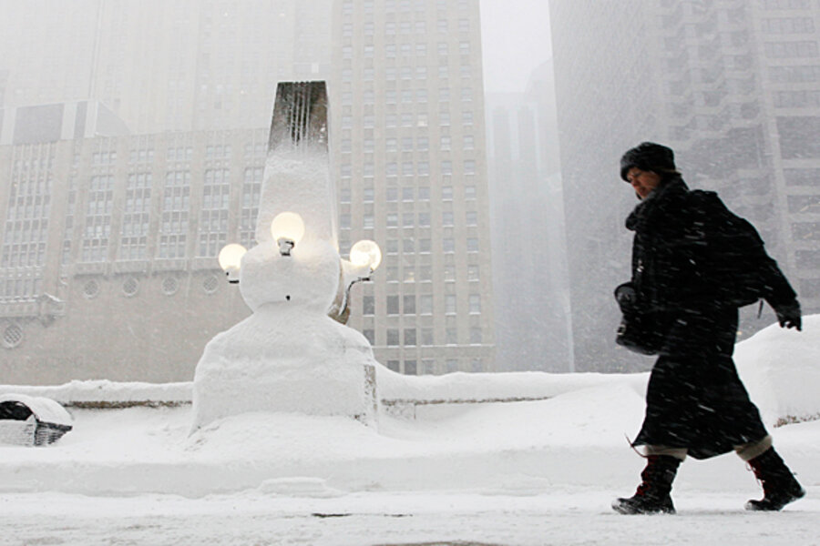
Winter storm raises the question: What's going on with the weather?
Loading...
In Chicago, they called it the Blizzard of 2011. At Accuweather, a forecasting service, it was known as the Groundhog Storm.
By whatever name, the vast winter storm that spun its way across the US in the opening days of February is but one sign that this winter will be memorable.
Indeed, this winter marks the second in a row during which closely related, large-scale climate patterns over the Arctic and North Atlantic have combined to deliver biting temperatures and heavy snowfall to the eastern half of the country – including spots where snowfall is rare.
In particular, the weakening of a high-altitude polar wind has allowed cold air to dip southward more often than usual, and pressures over the North Atlantic have aided in slotting storm after storm into similar tracks across the US.
Scientists caution that it is far too early to speculate on whether these climate patterns are part of a new normal for North American winters. Over the long term, none of the storms this winter or last are unprecedented, notes Deke Arndt, who heads the climate monitoring branch at the federal government’s National Climatic Data Center (NCDC) in Asheville, N.C.
But they raise questions, and scientists are looking a wide range of data – from summer sea-ice levels in the Arctic to rainfall over the Indian Ocean – to better understand the global mechanics behind when and how these climate patterns shift.
To be sure, the past two winters “have not been like the slew of winters we’ve seen over the past couple of decades,” says Mr. Arndt.
The Deep South and Southeast have experienced bouts of deep freeze and snowfall they typically don’t experience. Meanwhile, the West has experienced warmer-than-usual winter temperatures – a trend that was perhaps most obvious last winter when the Vancouver Winter Olympics were deluged by rain.
A heavy-hitting lineup
This January’s lineup of storms highlights the point.
Between Jan. 9 and Jan. 13, for instance, a storm system brought heavy snow and freezing rain to a broad swath of the South and East. In the Southeast, Bakersville, N.C., recorded 20 inches of snow, while the storm brought 24 inches to Windsor Lock, Conn. Once the storm passed, 49 of the 50 states had some level of snow cover.
Between Jan. 25 and 27 another storm system blanketed large portions of the eastern US in snow. The heaviest snows fell on the Northeast, with New York reporting thundersnow and 19 inches of new snow in Central Park. According to NCDC records, the storm was among the Top 10 for snowfall in New York and Philadelphia.
Likewise, more snowfall records have been set around the country than record-low temperatures this winter. In December and January, only 12 communities broke or tied previous low-temperature records. But 202 communities broke single-storm snowfall records, while 54 more tied a previous record.
Most of the snowfall records are topped by an additional inch or two of snow. Not so in Siloam, Ga., 76 miles east of Atlanta. Siloam’s previous record boasted a “trace” of snow on Dec. 3, 1971. A storm that hit the area on Dec. 26 dumped 10 inches of white stuff on the community, according to NCDC data.
Meanwhile, total snowfall in December and January for major eastern cities is running well ahead of last year, according to data gathered by Accuweather. New York tops the list. By Jan. 31, 2010, the city had seen 14.5 inches of snow. As of Jan. 31, 2011, slightly more than 56 inches had fallen on the Big Apple.
On the other hand, Washington, D.C., has been catching a break. Last year, the nation’s capital had received 24 inches of snow between December 2009 and January 2010; for the same period this winter, storms have brought nine inches of snow.
‘Oscillation’ plays a role
Two closely related climate patterns have had a significant influence on winter-storm history this winter and last, say specialists.
They point to a phenomenon at the top of the world called the Arctic Oscillation, which appears as a swing between weaker and stronger atmospheric-pressure differentials over the Arctic and at mid-latitudes. When the pressure differences are smaller than normal, a high-altitude wind encircling the Arctic, known as the polar vortex, weakens, allowing cold air to drive south more frequently than when the pressure differences and the vortex are strong.
The Arctic Oscillation – which varies over periods ranging from weeks to decades – has been in a weak, or negative phase, since mid-November, with its weakest stage so far this winter running from mid-December to mid-January.
Meanwhile, over the North Atlantic, another climatological mood swing known as the North Atlantic Oscillation has played an influential role in setting up storm tracks as they migrate over eastern North America across to Europe.
During the oscillation’s “positive” phase, an area of strong low pressure is centered between southern Greenland and Iceland, while a strong high pressure region sits near the Azores.
This tends to bring mild, wet winters to the eastern US, a wetter winter to central and northern Europe, and cold, dry winters to northern Canada and Greenland.
In a negative phase, each pressure regime weakens and moves slightly, bringing more storms to the southern and middle Atlantic states and southern Europe, but drying out northern Europe.
Since mid-November, the North Atlantic Oscillation has remained largely in a negative phase, although with February has come a poke into positive territory.
Beyond the tropics, the North Atlantic Oscillation is the dominant driver of weather and climate during Northern Hemisphere winters, says James Hurrell, a senior scientist at the National Center for Atmospheric Research in Boulder, Colo.
Some researchers argue the Arctic and North Atlantic Oscillations are one broad phenomenon.
Other say they are siblings. Either way, these oscillations play such influential roles in winter weather patterns that researchers are trying to identify the factors that tip the swings to one long-term average phase or the other.
For instance, atmospheric scientist Judah Cohen says he is looking at the possibility that the Arctic Oscillation’s two-decade tendency to run negative may be linked to the decline in Arctic sea-ice extent during the spring and summer melt season.
The implication: further expected declines in summer ice extent could shove the Arctic Oscillation into a negative phase more often than not for some time to come, says Dr. Cohen of Atmospheric and Environmental Research, a weather and climate risk-management firm in Lexington, Mass.
How better predictions can help
For his part, Dr. Hurrell says uncovering some level of predictability – however modest in the North Atlantic Oscillation (NAO) – over time frames of a decade or two “could be extremely important.”
Norway, for instance, derives much of its energy from hydroelectric dams, which rely on precipitation in the mountains. Snowfall there, he says, “is extremely highly correlated to the phase of the NAO.” Even assigning a probability that the NAO is about to undergo a long-term shift, in average phase could help energy planners there, he says.
One key may lie thousands of miles away, over the Indian Ocean. During the past five to 10 years, he says, tantalizing evidence has emerged that rainfall trends over the Indian Ocean may tweak atmospheric circulation patterns in ways that affect conditions over the North Atlantic.
Specifically, as the Indian Ocean warms and rainfall increases, the storms trigger changes in the atmosphere that lead to a generally positive North Atlantic Oscillation.


