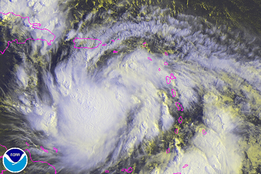
Latest storm track for Isaac's destination: Florida panhandle to Alabama
Tropical storm Isaac has crossed into the eastern Caribbean, where it's expected to reach hurricane strength briefly before sweeping across sections of the Dominican Republic, Haiti, and Cuba over the weekend.
From there, the current forecast from the National Hurricane Center in Miami shows the storm regaining hurricane strength as it travels a path that could put it about 130 miles west of Tampa, Fla., by Aug. 28, where the Republican National Convention will be in full swing. Over the past 24 hours, successive forecasts have moved Isaac's location progressively farther west and away from the convention site.
By Tuesday, forecasters expect the storm to have become a Category 1 storm, with maximum sustained winds of about 80 miles per hour.
Track forecasts so far in advance carry errors of up to 225 nautical miles east or west of the currently projected track. And the storm's impact also depends on how far gale, tropical-storm, and hurricane-force winds extend from Isaac's center.
Still, over time, a number of long-range forecasting models in the US, Europe, and Canada have been converging on a broad path that takes the storm into the eastern Gulf, with some indicating landfall somewhere between the Alabama coast and the western end of Florida's panhandle by Aug. 30.
As of 11 a.m. Eastern Daylight Time, Isaac's center – roughed up during the storm's encounter with the Leeward Islands – was located about 240 miles west southwest of Guadeloupe.
Forecasters have posted hurricane warnings for Haiti and the Dominican Republic's south coast. Puerto Rico and the northern coast of the Dominican Republic are under tropical-storm warnings. Isaac's maximum sustained winds are hovering at about 40 m.p.h. and extend as far as 140 miles from the storm's center.
So far, the storm appears to have left little damage in its wake.
"Skies were very black and cloudy most of the day" on Wednesday, a resident on the island of Dominica told the Associated Press. "But it's been pretty quiet so far. Some rain, very little wind."
Heavy rains hit Guadeloupe, where the biggest concern was flooding. But so far, no reports of casualties or damage have surfaced.
Meanwhile, Puerto Rico's governor has declared a state of emergency in advance of Isaac's arrival and has activated the National Guard. The Federal Emergency Management Agency has sent response teams to work with officials in Puerto Rico and the US Virgin Islands.
One area of particular concern along Isaac's projected path is Haiti, where some 400,000 people are still huddled in makeshift shelters after the country's devastating earthquake in 2010 and so remain vulnerable to wind and flooding.
Forecasters also are tracking tropical storm Joyce, which until Thursday was tropical depression 10. The storm, located 1,315 miles east of the Leeward Islands, is projected to head northwest through Monday morning, then head on a northerly path that takes it east of Bermuda.


