Blizzard 2013 Live blog: Nine-state region returns to normal – sort of
Loading...
| Boston
Sunday 6:30 p.m.
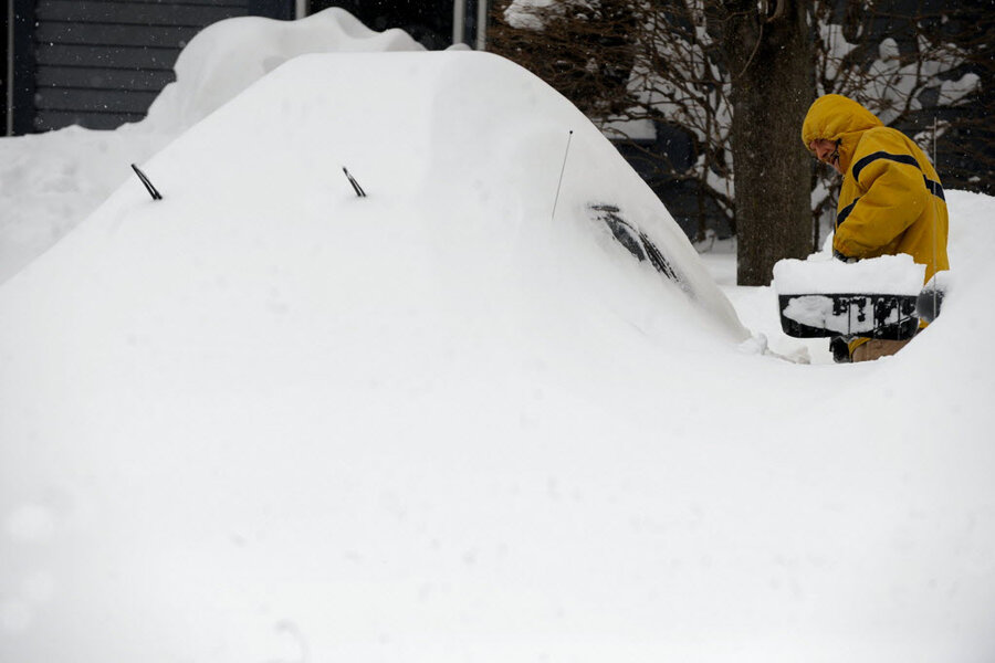
The nine-state region of the United States that got whacked by the Blizzard of 2013 is slowly returning to normal – if by “normal” you mean a winter wonderland where some people are still snow-shoeing to work or digging out cars that look more like igloos, hundreds of airline flights are being canceled, and hundreds of thousands remain without power.
About half of the 650,000 businesses and homes that lost power now have the lights back on and their computers humming (although whether they can link to the rest of the online world depends on whether their ISP’s are up as well). But that leaves some 310,000 still without power as of Sunday afternoon – 234,000 of those in Massachusetts.
Starting Friday, airlines had canceled roughly 5,700 flights into and out of the Northeast.
But airlines are now operating “close-to-normal schedules,” the Associated Press reports. Still, that meant some 450 cancellations Sunday, and airlines were urging passengers to check with their airline before braving a snowy trip to the airport.
Public ground transportation is improving. Most New York City subways and buses were operating on a regular schedule. The Massachusetts Bay Transportation Authority plans to operate on regular schedules Monday, but the agency said commuters should expect "significant" delays.
While skies were clear and the storm had passed, “Anxiety Grows as Thousands Remain Stranded and in the Dark After Storm,” as a New York Times headline writer put it.
Many no doubt will try to make it to work Monday, but telecommuting may be a more prudent choice for thousands as public transportation remains iffy and plows still work overtime to clear two-lane roads that remain one-lane.
In Connecticut, which got record amounts of snow and where President Obama declared a state of emergency Sunday, Governor Dannel Malloy asked all nonessential state employees to stay home on Monday.
The economic impact of the weekend storm could be huge.
“What's worse is that the blizzard came at a time when many businesses are still struggling to recover from October's Superstorm Sandy, which forced the New York Stock Exchange shut for a few days, and shuttered small businesses for months,” reports CNN Money. “It slowed home building and kept people out of work.”
So the storm might have passed, but not its costly aftermath.
Saturday 7:20 p.m.
Tallies from the Weather Channel, the Associated Press and other sources show snow storm records broken across the nine-state region whacked by Blizzard 2013 over the weekend.
In Hamden, Connecticut, 40 inches of snow fell – the largest total attributable to Blizzard 2013 so far. Portland, Maine, broke a 34-year record with just under 32 inches. Three more states recorded at least 30 inches (Massachusetts, New Hampshire, and New York).
Winds topped 80 miles an hour near Cuttyhunk, Massachusetts; Westport, Connecticut; and Mt. Washington, New Hampshire.
Winds and heavy snowfall knocked out power to some 650,000 homes and businesses, more than 400,000 of those in Massachusetts. The winds also brought significant coastal flooding from New England to parts of the Mid-Atlantic Seaboard.
The US Postal Service’s unofficial creed states in part that “neither snow, nor rain, nor heat, nor gloom of night, nor the winds of change, nor a nation challenged, will stay us from the swift completion of our appointed rounds.”
But it seems that a good portion of the nation challenged by brutal winter weather indeed did stay those delivering the US mails from any completion of their appointed rounds – at least on Saturday when mail delivery was canceled across New England. (Was it an omen or perhaps a rehearsal for the just-announced time when all Saturday deliveries will be ended?)
More than 5,000 airline flights were canceled, although flights to the New York region started landing at JFK, LaGuardia, and Newark Saturday morning, and Boston's Logan hopes to open partially by 11 p.m. Saturday night, the Associated Press reports.
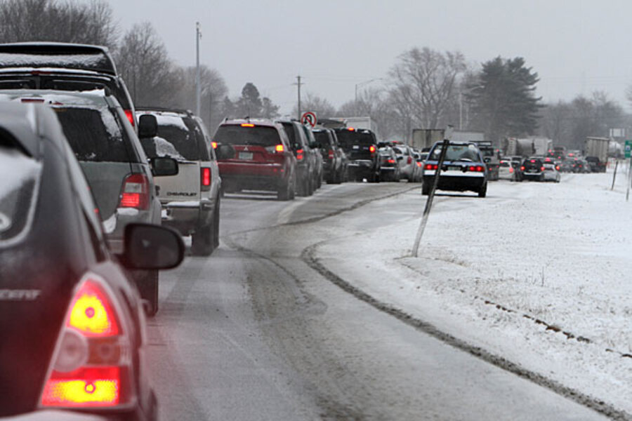
Highways in Massachusetts, Connecticut and Rhode Island (where the governors had imposed travel bans) began opening up late Saturday afternoon, but not before the National Guard had to help clear some roads, rescuing some 90 stranded motorists. In some areas, snowmobiles were pressed into service when snowplows themselves got bogged down or were blocked by cars stuck in the snow.
Life went on as usual for some, the AP reports. In Portland, Karen Willis Beal got her dream wedding on Saturday – complete with a snowstorm just like the one that hit before her parents married in December 1970. "I have always wanted a snowstorm for my wedding, and my wish has come true to the max," she said.
In Massachusetts, the National Guard and Worcester emergency workers teamed up to deliver a baby at the height of the storm at the family's home. Everyone was fine.
The AP also reports that several NBA trips were extended: “The Knicks were stuck in Minnesota, the Spurs hunkered down in Detroit and the Brooklyn Nets took the train home from Washington.”
Saturday 11:20 a.m.
New Englanders awoke Saturday to more than 2 feet of snow, the Associated Press reports, with the record so far being more than 38 inches in Milford, Connecticut. All roads remained closed in Connecticut.
The snow made travel nearly impossible even for emergency responders who found themselves stuck on highways all night. In the shoreline community of Fairfield, police and firefighters could not come in to work, so the overnight shift was staying on duty, First Selectman Michael Tetreau told the AP.
"It's a real challenge out there," Tetreau said. "The roads are not passable at this point. We are asking everyone to stay home and stay safe."
Meanwhile, airlines canceled more than 5,300 flights as New York’s three major airports and Boston’s Logan airport remained closed. The US Postal Service canceled Saturday delivery across New England.
About 650,000 customers in the Northeast lost power during the height of the snowstorm, most of them in Massachusetts and Rhode Island. The Pilgrim Nuclear Power Plant in Plymouth, Mass., lost electricity and shut down Friday night during the storm. Authorities say there's no threat to public safety.
Massachusetts Gov. Deval Patrick enacted a statewide driving ban for the first time since the Blizzard of 1978 that dropped 27 inches of snow, packed hurricane-force winds, and claimed dozens of lives. Nearly 22 inches of snow have fallen in Boston so far and up to 3 feet is expected, according to the National Weather Service. Rhode Island residents were ordered off the roads as well.
Flooding has been a concern along the coast. Two neighborhoods in Quincy, Mass., south of Boston, were evacuated as well as 20-30 people in oceanfront homes in Salisbury in northeastern Massachusetts. But it did not appear to create major problems in New York and New Jersey, states hit hardest during last October's Superstorm Sandy.
At least six deaths have been blamed on the storm, including three in Canada.
Saturday 1:10 a.m.
The challenge of this blizzard isn’t just the whiteouts, it’s the blackouts.
The number of people without power due to downed trees and other problems increased sharply during the evening.
The electric utility NStar shows widespread power outages in the Cape Cod region. Utilities serving other coastal areas from Long Island to New London, Conn., appear to be similarly hard it.
CNN, in a news alert early Saturday morning, said nearly 530,000 customers have lost power in nine northeastern states during the blizzard that is blanketing the region.
Over 300,000 of those outages hit Massachusetts, CNN said.
One Massachusetts utility – National Grid – reported 99,000 customers without power as of 10:44 p.m.
The Hartford Courant in Connecticut headlined a story “Outages spreading as storm rages on.” It said 26,718 Connecticut Light & Power customers lacked power by 9:15 p.m.
So, even as plow trucks are working to push back the snow, power companies will be trying to repair damaged lines – a task complicated by a forecast for Saturday of continuing light snow with more wind gusts possible.
Saturday 1:00 a.m.
In case you can’t see out your windows anymore, or are just wondering from an armchair in Palm Springs, the snow is still falling steadily across much of the Northeast.
The Weather Channel website, Weather.com, reports accumulation of 12 in Woonsocket, R.I.
And the storm they’re calling Nemo is expected to keep dumping more throughout the night, bringing with it winds that have left thousands of people without power.
A National Weather Service update in the region late in the day: “Little change to the forecast as blizzard conditions are expected overnight.” The NWS added that snowfall rates will reach two to four inches per hour.
Forecasters have predicted the bulk of the snow will be done by the time most people are having breakfast, but lingering light snowfall – and the job of plowing and shoveling – promise to continue well into Saturday.
Also, electric crews will be busy trying to mend power lines, after downed tree limbs and other problems caused numerous power outages from New Jersey to Cape Cod.
Here are some other vignettes from a snowy Friday, via the Associated Press:
[] In Maine, registration and practice runs for the National Toboggan Championships in Camden were held as scheduled, but Saturday's races were postponed for a day.
[] In addition to airport and rail shutdowns in the region, the Massachusetts Steamship Authority suspended all ferry service between Nantucket and Hyannis, and between Martha's Vineyard and Woods Hole.
[] In New York suburbs, the storm forced the postponement of two "disaster recovery" workshops being held by the Federal Emergency Management Agency. The workshops were for homeowners and businesses still recovering from the superstorm called Sandy in October – nothing to do with the current storm.
Will Nemo be one for the record books? We’ll have to wait until morning to find out. For now, plow trucks are busy out in the roaring winds, and everyone else has been told to stay indoors.
Friday 7:43 p.m.
TV meteorologists across the Northeast are positively giddy over reports of “thundersnow,” a rare atmospheric phenomenon that is exactly what it sounds like: a thunderstorm in a blizzard.
(This is the part where you point out that “Thundersnow” would be a great name for a heavy metal band. Except that it’s already taken. They’re still looking for a drummer, though.)
Thundersnow – or, as we prefer to call it, Thündërsnöw – is relatively rare phenomenon, especially in the Northeast. It’s more likely to occur in the central United States, the intermountain west, and the Great Lakes region.
It tends to accompany heavier snowfall. The snow acts as an acoustic damper, meaning that the thunder can be heard for only two or three miles. In other words, if you hear thunder it likely means that you are getting lots and lots of snow right now.
Friday, 6:55 p.m.
The Shows must go on!
Harvard University's Hasty Pudding roast for Golden Globe-winning actor Keifer Sutherland was set to take place Friday evening in Cambridge despite the storm.
As of 3 p.m., all but one On Broadway and Off-Broadway productions in New York City were scheduled to go on as planned. The exception was Talley’s Folly, according to BroadwayWorld.com.
Can’t get to NYC tonight?
The following Broadway shows are offering advance exchanges - before the performance - for customers who are unable to attend the Friday, February 8 evening performance, due to the winter storm: Chicago, Cinderella, Mamma Mia!, Nice Work If You Can Get It, Once, The Phantom of the Opera. Who's Afraid of Virginia Woolf, The Other Place, Rock of Ages, The Heiress, Jersey Boys, The Book of Mormon, Manilow on Broadway.
Similarly, some Saturday shows are offering to reschedule tickets for patrons who can’t get to the theater. BroadwayWorld.com has a list of the productions making this offer.
And necessity is the mother of invention: Welcome to Blizzard Fest!
The blizzard forced the cancellation of the Friday night performance by acoustic double-neck guitarist Ian Case at Sunapee Coffeehouse in Sunapee, NH.
“So instead we are bringing you "Blizzard Fest", a full concert streamed to you live (video as well as high quality audio) from our living room to yours!
Tuning in is simple: go to http://www.ustream.tv/channel/ian-ethan at 7:30pm eastern time this Saturday (Feb. 9) and enjoy a 1.5-hour concert from the comfort of your home!”
Friday 5:30 p.m.
All flights in or out of Boston’s Logan Airport have been cancelled. The MassPort website recommends that travelers contact their airlines for when flights will begin again.
There are reports that New York City's airports are also seeing few if any flights in or out tonight.
The website FlightAware shows that 3,142 flights have been canceled in US today (almost all Nemo-related) and another 1,224 have been canceled for tomorrow.
Friday 5:12 p.m.
How will Nemo stack up compared to other snowstorms?
The Monitor's Pete Spotts looked at weather records in Boston dating back to 1892. His conclusion: If Logan Airport measures more than 22.8 inches, it will be in the top five.
Here's a list of the top 10 snowstorms in Boston since
1. February 17-18, 2003: 27.5 inches
2. February 6-7, 1978: 27.1 inches
3. February 24-27, 1969: 26.3 inches
4. March 31-April 1, 1997: 25.4 inches
5. January 22-23, 2005: 22.5 inches
6. January 20-21, 1978: 21.4 inches
7. March 3-5, 1960: 19.8 inches
8. February 16-17, 1958: 19.4 inches
9. February 8-10, 1994: 18.7 inches
10. December 26-27, 2010: 18.2 inches
10. January 7-8, 1996: 18.2 inches
10. December 20-22, 1975: 18.2 inches
Friday 5:05 pm
State of Emergency in Five States
Five states – New York, Massachusetts, Rhode Island, Connecticut , and Maine – have declared a ‘state of emergency.’ Three states have now issued travel bans.
Massachusetts Gov. Deval Patrick issued an executive order to ban private vehicle from the roads. Only public safety workers and public works vehicles will be allowed on the road. The ban took effect at 4 p.m.
A violation of the ban could result in a penalty for up to one-year in prison and a hefty fine could be handed out if the ban is violated.
“The point is not to figure out how to come down hard on people; it’s to emphasize that non-essential travel on the roads cease,” said Patrick. “We have to have as many people off the roads as possible.”
The Connecticut Department of Transportation has also issued a travel ban as of 4 p.m. Friday to keep citizens off the road while plows do their work – and to prevent accidents in the deteriorating conditions.
And Rhode Island Gov. Lincoln Chafee issued a similar travel ban as of 5 p.m.
While a “state of emergency” sounds like something issued by a dictator to quell civil unrest, it’s often declared during “natural” disasters. It allows governments to activate the state’s emergency plans, allow state governments to cut through the red tape to provide resources to help localities, activate the national guard for disaster assistance, and temporarily suspend certain laws or agreements that may hamper immediate emergency assistance.
For example, Maine governor Gov. Paul LePage signed what he described as a limited declaration of emergency that he said waives federal Department of Transportation rules and allows snowplow and utility crews to work longer shifts and to bring in Canadian crews, if necessary.
Friday 4:05 p.m.
Power outages from storm?
Not many yet, but it’s good to be prepared.
As of 3:30 p.m. Friday afternoon, the major storm sweeping the Northeast hasn’t caused many power problems. NStar, for one, a major electricity provider in the Boston area, had only some faint beige colors on its outage map – a signal that some communities had outages affecting fewer than 1 percent of homes.
Maybe it’ll stay that way. But this is a wet snow, and a lot of it, combined with occasional strong gusts of wind.
So here are a few steps to consider while power is still on … and if it goes off:
• Charge your cellphone and other devices. You’ll want your phone to last as long as possible, and things like an iPad might offer some fun diversions during a power lapse.
• Keep emergency supplies handy: Flashlights, candles, matches, and a battery-operated or hand-crank radio.
• Have a list of essential phone numbers, including for your power company.
• If the power goes out, don’t open your fridge or freezer. That will prolong the time that food stays safe (a rule of thumb cited by food-safety experts is that perishable food should stay below about 40 degrees Fahrenheit). NStar, for example, says the food in a fridge should be good after a 6 to 9 hour outage, while frozen food should last through 36 hours. Of course, if it’s below 40 degrees Fahrenheit outside, the world is your icebox.
• In a blackout, be ready to keep a trickle of water flowing to prevent freezing pipes.
• Stay warm by dressing in layers, wearing a hat, and using quilts or blankets.
• Stay clear of any fallen electric wires. Assume that every fallen power line is live. And if you use a power generator, follow safety guidelines carefully.
• Consider how you may be able to offer help to neighbors.
Below is a list of outage maps for the states most affected by the blizzard:
Connecticut
United Illuminating
Connecticut Light and Power
Maine
Central Maine Power
Bangor Hydro
Massachusetts
National Grid
Western Massachusetts Electric
NSTAR
New Hampshire
Public Service of New Hampshire
New Jersey
Orange and Rockland Power
Atlantic City Electric
PSEG
Jersey Central Power and Light
New York
New York City (Con Ed)
Central Hudson Valley (Cen Hud)
Long Island (LIPA)
Northern and Western NY (NYSEG)
Niagara Mohawk
NYSEG
Rochester Gas and Electric
Vermont
Statewide power outages
Green Mountain Power Vermont Electical Cooperative
Friday 3:50 p.m.
Cool Animated Computer Weather Model
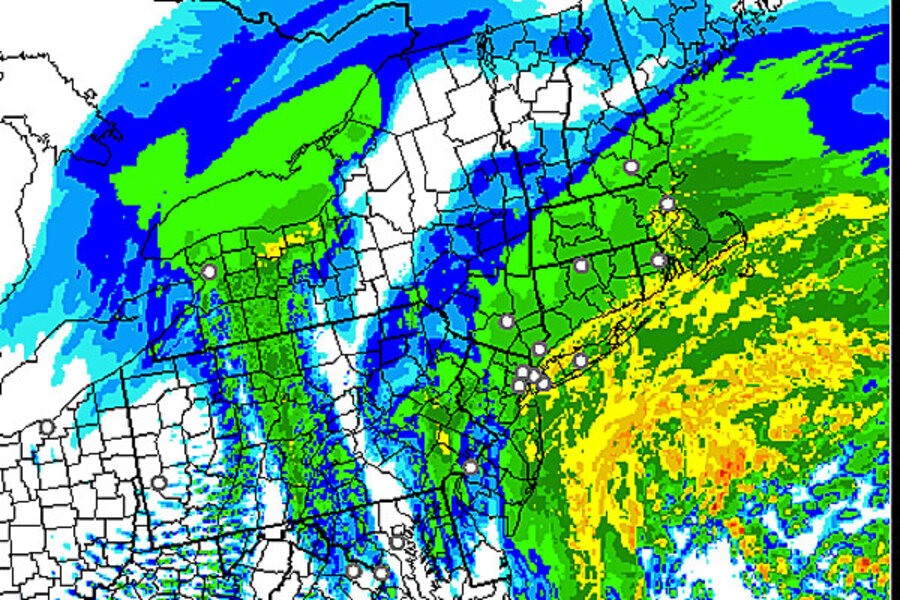
Check out this cool animated NOAA experimental weather model showing the convergence of the two low systems over New England. The model shows the projected snow. This is a Doppler radar model which shows the precipitation (snow) as green, yellow (heavier snow) and red (the heaviest snow). It’s in UTC time (-5 hours EST).
This model starts at 10 a.m. EST Friday and goes to midnight Friday.
While it shows the storm apparently heading out to sea and slackening at midnight Friday, the swirl of yellow (heavy snow) off the coast of New England is expected to swing back over land, bringing continuous snow until Saturday morning.
Dave Epstein, a meteorologist who blogs on Boston.com. writes that “I still expect the heaviest snow to occur from about 7 PM until 5 AM. During that time 10 to 18 inches of additional snow should fall across much of eastern Massachusetts with 6-12 inches falling across the western third of the state.”
And Epstein tweeted
“Latest computer guidance still suggests big numbers, but I do think most of snow is done by 7-8AM tomorrow. Only 2-4" after sunrise tomorrow.”
Friday 2:35 p.m.
The Monitor's Husna Haq reports that Nemo is canceling flights, shutting down mass transit, and closing roads throughout the region. She quotes an official New York’s division of Homeland Security and Emergency Services, who says that travel on Friday night into Saturday will be "almost impossible."
Friday 2:05 p.m.
The Nemo has landed.
The winter storm with that unofficial name is showering New England with snow, making driving difficult.
The safest option: Don’t drive. Mayors across the region have advised people to off the streets if possible. In Massachusetts, governor Deval Patrick ordered all vehicles off the roads by 4 p.m., under penalty of a $500 fine and up to one year in prison. The storm is really that big.
If you must venture out, here are some helpful reminders about winter driving safety, courtesy of AAA and the Transportation Department in Missouri (hey, it’s the “Show-me State” that can sometimes become a “Snow-me State).
• Carry emergency supplies if you can: Blankets, water and some food, a flashlight, extra clothes, a bag of sand, a shovel.
• Accelerate and decelerate slowly. “Applying the gas slowly to accelerate is the best method for regaining traction and avoiding skids,” AAA says. And of course, “It takes longer to slow down on icy roads.”
• Don’t stop going up a hill. You might have trouble getting any upward momentum again.
• If you get stuck, stay in the vehicle. “It's easy to become disoriented and lost [walking] in blowing and drifting snow,” the Missouri officials say. Keep your exhaust pipe clear of snow, and run the engine about 10 minutes per hour. A colored cloth hung on your antenna can help signal trouble.
Seriously, though: Unless you’re driving a snow plow, it’s better to just stay off the roads.
Friday, 2:05 p.m.
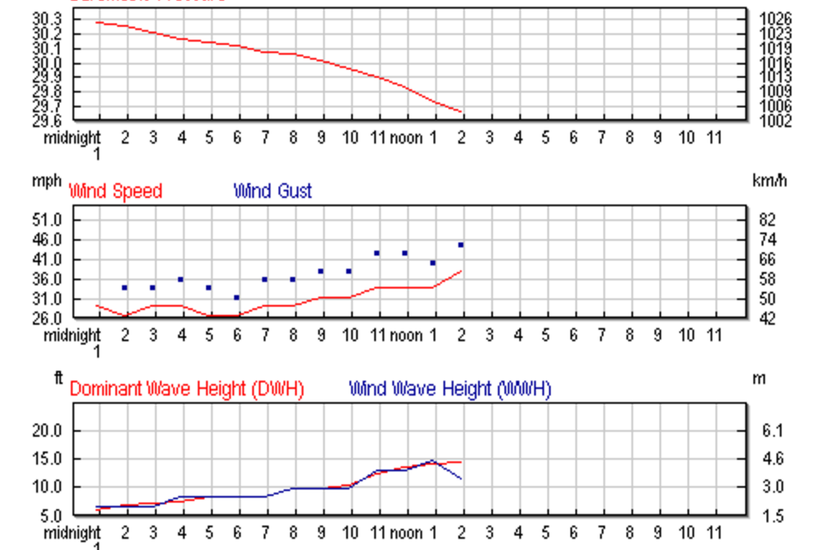
As the storm moves into the region winds and waves are picking up off Long Island.
The chart below shows wind gusts reaching 35 miles an hour, and climbing. It shows wave heights have tripled since midnight, to about 15 feet. The data was collected from the NOAA weather buoy floating some 30 nautical miles south of Islip, New York. You can track the data for yourself at this link here.
Friday 1:50 p.m.
Even before the first snowflake appeared, today's blizzard has drawn dismissive comparisons, usually from Baby Boomers and their elders, with the Blizzard of 1978:
"30 lousy inches?!" They'll inevitably begin, "That's nothing. Why, back in '78...."
If this disco-era comparison isn't enough to blacken your mood ring, just wait for the stories about the gas shortages of 1979. CNN reports that gas lines are stretching for blocks in the New York area.
Alarming as they may appear, these gas lines aren’t a signal of any prolonged shortage, says CNN, but rather a result of bad memories of Superstorm Sandy, when fuel supplies ran low in many parts of New York and New Jersey. Indeed, the storm will keep lots of cars off the roads this weekend, likely resulting in a very groovy surplus. So don't expect president Obama to don a cardigan any time soon.
Friday 1:25 p.m.
The Monitor's Pete Spotts reports that the National Weather Service, which had predicted 18 to 24 inches of snowfall, has now revised its forecast to more than 24 inches. The reason: Slight changes in the tracks of the storm systems, along with a mass of cold air behind one of them.
Friday 12:10 p.m.
Boston Mayor Menino has officially "closed' the streets of Boston to parking as part of the snow emergency.
Friday 11: 59
No school, but not enough for good sledding or building a snow fort - yet.
Major school systems are closed today in New England, and in some upstate New York towns. That makes it a “snow day,” but there’s not much white stuff for kids to play in.
With snow starting in Boston as of late morning, it looks like the typical school day could be mostly over before there’s significant accumulation. But school systems had to make their call, based on forecasts that driving conditions this afternoon could be bad.
“Even before the first snowflake had fallen, Boston, Providence, R.I., Hartford, Conn., and other towns and cities in New England and upstate New York towns canceled school Friday,” the Associated Press reports.
So it could be a good day for playing indoors. How about a game of Monopoly, using the venerable (collectable?) clothes iron as a playing piece?
How are you spending your snow day?
Friday 11:50 a.m.
What's the Twittersphere is saying about the blizzard of 2013?
Social media is a great tool for following the Great Blizzard of 2013 (aka Nemo).
Here's a sampling pulled from #Nemo on Twitter.
Matt Noyes @MattNoyesNECN - RT @massstatepolice: MSP Revere assisting RPD, WPD in closing Winthrop Shore Drive in anticipation of storm surge...reopen after surge
In other words, the Mass State Police are assisting the Revere Police and Winthrop Police (north of Boston) to close Withrop Shore drive. Storm surges of 14 feet are forecaste overnight.
WBZ Boston Weather @wbzweather - I expect an average of 5" in eastern MA by 7PM then 15" by 1AM then 23" by7AM! WOW!!!
Snow has been falling in Boston for a few hours now.
Marlee Matlin @MarleeMatlin - Please stay safe in #nemo 's path. Follow the @RedCross for information on shelters. Also check in the elderly or those who live alone.
Be a good neighbor.
Poynter @Poynter - "We’re not using that arbitrary name for the storm. It’s meaningless": Who is & isn't using #Nemo http://journ.us/TUs338 Plus: "Holy Plow!"
The Poynter Institute is following the debate within the media and among meteorologists about calling this winter storm Nemo. Their conclusion, Nemo is winning in social media sphere.
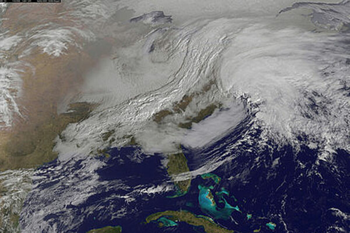
NASA Goddard Images @NASA_GoddardPix - Call it what you want (#nemo) but this winter nor'easter is looking massive: http://bit.ly/127tutV
Check out the NASA satellite photo of "Nemo."
Friday 10:58 a.m.
When will public transportation shut down?
If you're working in the New England area, this isn’t your normal commuting day.
Subway, bus, and rail systems are prepping for an early shutdown Friday due to the big blizzard that the Weather Channel has named Nemo.
Snowfall totals by Saturday could reach 3 feet in Boston and a foot in New York City.
In Boston, where snow has now started to fall downtown, the “T” transit system will shut down at 3:30 p.m.
Storm conditions are predicted to worsen quickly after that. The Massachusetts Bay Transportation Authority (MBTA) announced the shutdown schedule on Thursday afternoon, giving commuters and residents time to plan and adapt. The MBTA says its focus will be working to get the system back into operation as soon as possible after the storm.
Gov. Deval Patrick has ordered non-emergency state workers to stay home and told drivers of private vehicles to get off the roads by noon so snow plows can start work on keeping the streets clear. Public officials have learned the lessons of the Blizzard of '78 when streets became clogged for days with abandoned vehicles.
As of 11 a.m. the Mass Turnpike Authority (1-90) has issued a ban on double trailer trucks and propane haulers.
In New York, “customers are advised where possible to avoid traveling today, and if traveling is a necessity, to begin the trip home or to their final destination early,” the Metropolitan Transportation Authority system says in an advisory for subway, bus, and rail users.
“Service will be monitored on a route by route basis, and may be curtailed as conditions warrant,” the MTA says of city transit services.
The LIRR commuter rail from New York to Long Island says it will offer extra trains early in the afternoon, for workers heading home early.
The Metro-North Railroad, citing the storm’s “predicted severity,” said it will have more trains in the early afternoon and fewer during the typical p.m. peak. It added this warning: “Cancellations are possible at any time, but increase in likelihood as the evening progresses to prevent trains from becoming stranded during the storm.”
Other cities are also responding to the storm. Hartford, Conn., for instance, faces a likely transit shutdown starting at 6 p.m. Friday “if the storm develops as forecast.” The Greater Hartford Transit District warns of likely delays during the day, advising users to postpone travel until Sunday or Monday if possible.
Update Friday 10:20 a.m.
When can NYC expect blizzard conditions?
Currently, the rain-snow line runs lengthwise through Long Island, and cuts across Manhattan and New Jersey as the temperature hovers just above freezing.
As the two storms collide (see explanation below), and the low coming out of the Ohio valley injects cold air and the sun goes down, NYC is expected to turn to all snow and winds will pick up. Expect blizzard conditions to arrive around 6 p.m. in the New York City area.
The Weather Underground forecast for NYC tonight: "Overcast with snow. Low of 25F with a windchill as low as 16F. Windy. Winds from the North at 20 to 25 mph with gusts to 40 mph. Chance of snow 100% with accumulations up to 10 in. possible.
Mayor Michael Bloomberg said plows and 250,000 tons of salt were being put on standby.
"We hope forecasts are exaggerating the amount of snow, but you never can tell," Bloomberg said, adding that at least the bad weather is arriving on a weekend, when the traffic is lighter and snowplows can clean up the streets more easily.
The Associated Press reports that Amtrak said its Northeast trains will stop running Friday afternoon. The organizers of New York's Fashion Week — a closely watched series of fashion shows held under a big tent — said they will have extra crews to help with snow removal and will turn up the heat and add an extra layer to the venue.
At New York City's three main airports, most domestic carriers planned to cease operations between 2 p.m. and 5 p.m. Friday, resuming after noon on Saturday.
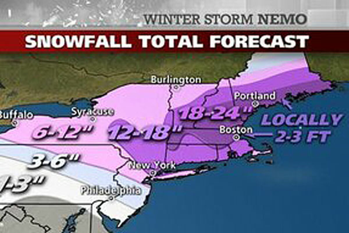
The forecast below shows why The Weather Channel's Jim Cantore is brandishing a yardstick in Boston today. While his colleague in NYC is carrying a 12-inch ruler. Will Nemo measure up to the hype?
Updated Friday, 9:50 a.m.
Thousands of airline flights canceled
US airlines are canceling thousands of flights in the Northeast Friday and Saturday because of a major winter storm, disrupting travel connections through some of the nation’s busiest airports.
The most affected airports include biggies like JFK and LaGuardia in New York City, as well as the airports in Newark, N.J., Boston, and Hartford, Conn.
With the possibility of two feet of snow or more falling in two days, coupled with high winds, the storm prompted airlines to act preemptively rather than wait until operations bog down.
As of 9:30 a.m. Friday, the tracking website FlightAware shows 2839 canceled flights in the US for Friday and another 821 for Saturday – with the likelihood the tally will keep growing.
For Friday, cancellations include more than 700 in the New York area, some 200 in Boston, and 150 in Toronto.
“We’ve relaxed our change-fee policies,” US Airways says in a weather advisory for Friday and Saturday. “If your trip is affected, you can change your trip online (in most cases) -- we’ll waive your change fees!”
Other airlines offer similar “weather waivers.” That doesn’t mean it will necessarily be easy for travelers to navigate around the storm, but it at least makes it a bit less punishing on the pocketbook.
Updated Friday, 9:35 a.m.
What’s a blizzard?
The American Meteorological Society and the National Weather Service say that to call a storm a blizzard, three conditions must exist for at least 3 hours:
1) winds in excess of 35 mph
2) considerable falling or blowing snow
3) visibilities of less than 1/4 mile
Wind is the ingredient that makes this storm more that just a big snowstorm. And in this case, there are forecasters who are expecting wind gusts to exceed 75 m.p.h. Or as Kevin Lemanowicz, the chief meteorologist for Boston's FOX25 TV news station, put it "We should see wind gusts above hurricane strength."
The National Weather Service defines hurricane force winds as those in excess of 74 m.p.h.
Those wind gusts will likely produce snow drifts as large as 5 to 7 feet high in the Boston area, if expected snowfall predictions are accurat.
Updated Friday 9:10 a.m.
Not one storm, but two.
Why is this storm expected to generate so much wind and snow?
It's actually two storms colliding and feeding off each other. One low pressure area is moving up the east coast, gathering strength as it feeds off the 68 degree waters of the Gulf Stream in the Atlantic. Another low pressure area is moving east from the Ohio Valley, bringing colder air. The collision of these two lows is likely to generate the high winds, and snow.
At the moment, the two lows have not merged. That's not expected until early Friday evening. Once that happens blizzard conditions are expected.
Here's how the National Weather Service forecast at 4 a.m described it.
ENERGY FROM A SURFACE LOW CROSSING THROUGH THE OHIO VALLEY SHOULD BEGIN INTERACTING WITH ENERGY FROM A COASTAL LOW TRACKING NORTHEASTWARD ALONG THE MID-ATLANTIC COAST EARLY FRIDAY. AS THE SYSTEMS MERGE...CONDITIONS WILL QUICKLY DETERIORATE OVER THE NORTHEAST ON FRIDAY WHILE THE COASTAL LOW RAPIDLY DEEPENS OFFSHORE.
Friday, 8:40 a.m.
Could this be a Top 10 Boston blizzard?
The National Weather Service blizzard warning out of Taunton, Mass., says:
A POTENTIAL HISTORIC WINTER STORM AND BLIZZARD IS EXPECTED
TO DROP UP TO 3 FEET OF SNOW THROUGH SATURDAY...
How much snow would it take to put this storm in the Top 10 of Boston blizzards?
The NWS has records dating to 1892, and says that there have been only six snowstorms of 20 inches or more in Boston, topped by the Feb. 17-18, 2003 snowstorm (27.5") and the infamous "Blizzard of '78" (Feb. 6-7; 27.1").
A snow total of 18.2" or more would place it in the top 10 list all-time, according to The Weather Channel.
Friday, 8:15 a.m.
Why are some folks calling the pending Blizzard of 2013 "Nemo?"
You can thank The Weather Channel. Late last year, The Weather Channel bestowed upon itself the mantle of official designator of winter storms. The National Weather Service was not amused.
Here's the Weather Channel's rationale:
- Naming a storm raises awareness.
- Attaching a name makes it much easier to follow a weather system’s progress.
- A storm with a name takes on a personality all its own, which adds to awareness.
- In today’s social media world, a name makes it much easier to reference in communication.
- A named storm is easier to remember and refer to in the future.
It's not about marketing, or hype, or generating more buzz and viewers for the Weather Channel. OK, well, it does help give the storm a personality. And that can't be bad for the TV narrative, right? It's really about awareness and safety.
In its explanation, the Weather Channel notes that Europe has named winter storms for years. And it says, no US government body has stepped up to tackle the task for the benefit of the public.
"There is no national center, such as the National Hurricane Center, to coordinate and communicate information on a multi-state scale to cover such big events. The National Centers for Environmental Prediction’s Hydrometeorological Prediction Center (HPC) does issue discussions and snowfall forecasts on a national scale but it does not fill the same role as the NHC in naming storms. Therefore, it would be a great benefit for a partner in the weather industry to take on the responsibility of developing a new concept."
Here's how the National Weather Service greeted the Weather Channel's first unofficially naming of a winter storm in November: "TWC has named the Nor'easter 'Athena.' The NWS does not use named winter storms in our products. Please refrain from using the term Athena in any of our products."
Local meteorologists were similarly unimpressed. "WTEN does not name "winter storms". Don't expect us to use someone else's nomenclature. Its dumb plain and simple..." wrote meteorologist Andy Gregorio of WTEN in Albany, NY.
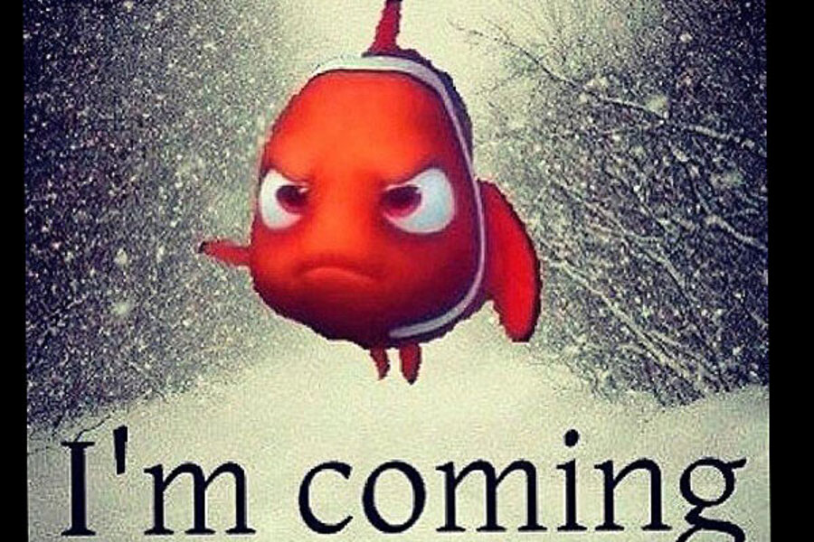
Why Nemo? Well, TWC says Winter Storm Nemo isn't named after the 2003 Disney movie "Finding Nemo" or the Capt. Nemo of Jules Verne's "20,000 Leagues under the Sea." It says, Nemo is "A Greek boy’s name meaning "from the valley," means "nobody" in Latin.
Hmmm. May be we should stick with the Disney character, if we're looking to give this storm a personality?
And TWC is right about one thing: "In today's social media world, a name makes it much easier to reference communication." In the Twitterverse the #nemo has emerged as a useful source of storm information, as well as entertainment. As @GloriaFallon123 writes:
"I think it's mean to name a crippling blizzard after a cute cartoon fish, as if women named Katrina and Sandy haven't suffered enough."


