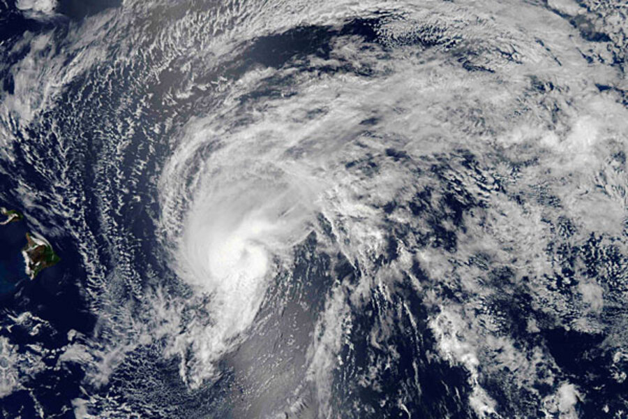
Tropical storm Flossie: Hawaii braces for first direct hit in 20 years
Hawaii was bracing for tropical storm Flossie Monday, even as the storm began to weaken.
According to the National Weather Service, the eye of the storm is headed directly for Maui and Oahu, with landfall expected Monday. Wind gusts could reach 60 miles per hour, but the greater threat is rain. Heavy rainfall could cause "life-threatening flash floods and mudslides, especially in the mountains."
The storm is expected to bring 6 to 10 inches of rain over Maui and the Big Island, with up to 15 inches possible in isolated locations, and 4 to 8 inches of rain over Oahu and Kauai, with isolated maximums of up to 12 inches possible.
Sustained winds up to 45 miles per hour were expected, and the NWS says that "dangerously high surf" is already hammering eastern-facing shores of the Big Island, and will soon spread to the other islands and continue through Tuesday.
The entire state is under a tropical storm warning and a flash flood watch through Tuesday night.
Forecasters on Monday said the storm is weakening rapidly as it shifts to the northwest. But Hawaii is still preparing for the worst, directing nonessential workers to stay home Monday and opening evacuation centers in numerous locations.
"We're going to continue to prepare for the worst," Hawaii island Mayor Billy Kenoi told the Honolulu Star-Advertiser. "We want people to exercise caution, stay off the roads if possible and minimize curiosity."
Hawaii's Civil Defense office urged residents to pay attention to flash flood warnings.
The Star-Advertiser also noted that Flossie is likely to be the first cyclone to hit the Big Island head-on in recorded history, and would be the first tropical cyclone to make landfall in the islands since Hurricane Iniki hit Kauai in 1992.


