Forecast is for 'normal' hurricane season, a bit wimpier than last year
The Atlantic hurricane season may be quieter this year than last, predict AccuWeather.com forecasters. A 'near normal' 2012 would see at least a dozen tropical storms and two major hurricanes.

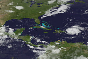
Hurricane Irene passes over Puerto Rico in late August last year. Compared with recent years, the coming 2012 hurricane season looks to be a bit calmer, forecasters say.
NOAA/AP/File
In a year of wild weather so far, hardly anyone would use the word “normal” in predicting what to expect in the future – except for long-range forecasters talking about the coming hurricane season.
On Thursday, AccuWeather.com predicted a “near normal” season of hurricanes. To the weather forecasters in State College, Pa., this means 12 named tropical storms, five named hurricanes, and two major hurricanes. If this forecast materializes, it would be a marked improvement over last year, when there were 19 named tropical storms, seven hurricanes, and four major hurricanes, including Irene, which caused $18.7 billion in damage along the East Coast.
“Even though we are forecasting a normal hurricane season, it only takes one hurricane to ruin your day,” says Dan Kottlowski, senior meteorologist and lead hurricane forecaster for AccuWeather.
Forecasters say making predictions far in advance of the storms allows communities to begin planning, and reminds people that they need to have an evacuation plan in place, even in noncoastal areas like Vermont, which got hammered by floods after remnants of Irene dumped vast amounts of rain on the state. Additionally, forecasters say, the public has a lot of curiosity about the coming hurricane season, and, over the years, long-term forecasts – created from statistical models – have become increasingly accurate.
“The computer models get a little better each year,” says Mr. Kottlowski. However, he also notes it is still difficult to predict where the storms might hit –whether it will be the East Coast or the Gulf Coast.
The AccuWeather forecast is similar to a prediction by Philip Klotzbach and William Gray of Colorado State University, who in early April predicted 10 named storms, four hurricanes, and two major hurricanes. NOAA’s Climate Prediction Center won’t issue its own prediction until May 24, about a week before the official start to the hurricane season on June 1.
Behind the forecast this year, says Kottlowski, is a variety of climate conditions that are starting to change in ways that will make development of major storms less favorable.
For example, the water temperatures off the coast of Africa and into the Caribbean are lower than in the past two years. This is likely to diminish potential hurricane activity in July and August, says Kottlowsi. The cooler water temperatures also result in higher atmospheric pressures, which are also a limiting factor. Additionally, the trade winds blowing across the Atlantic are stronger than normal, which causes more wave activity and results in colder water being pushed up from the bottom of the sea.
At the same time, weather forecasters say the La Niña current, which runs along the coast of South America, is just about finished. Computer forecasts indicate that a different current, an El Niño, will begin this fall. This is expected to create strong westerly winds that could shear the tops off potential hurricanes.
“It could mean we see cold fronts coming down sooner in the fall,” says Kottlowski.
Of course, the US might still experience hurricanes, despite all those changes. But the type of storms may be different. Kottlowski says it would not be unusual for cold fronts to stall off the coast and to see a storm develop off the front. AccuWeather refers to these as “home grown” storms that develop very quickly.
Whenever it forms, the first storm of the season will be named Alberto. In the past, says Kottlowski, “every Alberto was a wimp storm – no offense to any Albertos in the world.”

