Costa Rica earthquake: scientists saw it coming
A magnitude 7.6 earthquake hit Costa Rica Wednesday, rattling buildings in the capital, San Jose. Scientists had been cautioning that the region was due for another major quake soon.

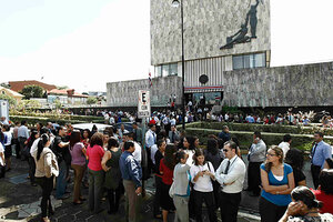
People gather in front of the Supreme Court after being evacuated from their buildings following an earthquake in San Jose, Costa Rica, Wednesday.
Juan Carlos Ulate/REUTERS
A powerful earthquake struck western Costa Rica Wednesday morning, prompting tsunami warnings for the Costa Rican west coast, as well as the coasts of Panama and Nicaragua.
Initially estimated at magnitude 7.9, the quake's intensity has been reduced to magnitude 7.6, according to the US Geological Survey.
The temblor was centered some 25 miles below the surface on the Nicoya Peninsula, a popular destination for ecotourism.
In the Costa Rican capital of San Jose, 87 miles east of the quake's epicenter, residents reported severe shaking that rattled utility poles and sent water sloshing out of swimming pools, according to the Associated Press. So far, no casualties have been reported.
Costa Rica's west coast lies along a subduction zone where one mobile plate in Earth's crust – the Cocos Plate – is plunging beneath the Caribbean Plate. This action has formed the Middle American Trench, which parallels the coastline offshore. This subduction zone also is responsible for raising a string of volcanoes that runs up the country's interior.
Subduction zones are responsible for the most violent earthquakes the planet's restless crust delivers, researchers say. The reason: The surface areas involved in subduction quakes, where the two plates are in contact with each other as the fault slants downward toward the Earth's interior, typically are far larger that the surface areas involved in the rupture of so-called strike-slip faults, such as California's San Andreas Fault. When a portion of a subduction zone locks up, it takes larger amounts of accumulated strain to overcome the friction locking the segment.
Indeed, during the past decade, researchers studying the seismic history of the Nicoya Peninsula have been cautioning that the region was due for another major quake soon.
The Nicoya Peninsula last saw an earthquake of comparable magnitude in 1950, according to Jeff Marshall, a geologist at California State Polytechnic University in Pomona. That quake registered a magnitude of 7.7 and led to dozens of casualties, heavy damage to buildings, up to seven feet of uplift along the peninsula's coastline, and soils in some regions that in effect liquefied with the shaking. That quake's epicenter appears to have been fairly close to the epicenter of Wednesday's quake.
Because the peninsula is home to subduction-style quakes that result in significant changes in the height of the coastline, the peninsula has become a Mecca for geophysicists studying such quakes, Dr. Marshall notes in an online summary of his research there.
In addition to the general scientific interest in subduction quakes, he notes that the pace of development on the peninsula is high and occurring "without heed for the lurking earthquake hazard."
Getting a better handle on the seismic and potential tsunami risks there could help government officials and the public at large better understand the risk the region faces, he suggests.

