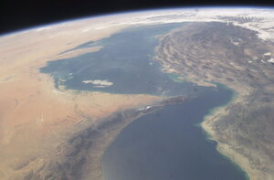
Scientists see unreported fish traps from space
Iran has not reported any fish caught in fishing traps called weirs, but Google Earth data shows that it has 728 such traps, representing 39 percent of the total regional haul from weirs.

A new paper has used Google Earth data to show that Persian Gulf countries are catching some 6 times more fish in what are known as weir traps than they are officially reporting to the United Nations.
NASA/AP
Not much can hide from Google Earth – including, it turns out, clandestine fishing traps along the Persian Gulf’s remotest stretches.
A team of University of British Columbia scientists has used Google Earth data on the Persian Gulf to report that fish traps called weirs could be catching up to six times more fish than the official reported number of weir trap catches in the region. Their research, part of the Sea Around Us Project and published in the ICES Journal of Marine Science, is the first to use satellite data to report on overfishing.
“These results, which speak to the unreliability of officially reported fisheries statistics, provide the first example of fisheries catch estimates from space,” write the authors, in the paper, “and point to the potential for remote-sensing approaches to validate catch statistics and fisheries operations in general.”
Fishing weirs are semi-permanent traps that use tides to a fish’s disadvantage. Now made of bamboo or wire, the coastal traps have been popular for more than 3,000 years and are still used throughout Southeast Asia, Africa, the Middle East, as well as along some slivers of North American coast.
It has long been known that these trap’s hauls are often unreported to official world bookkeepers. But pinning down just how many tons of fish are being pulled from the water without documentation has been difficult, since the areas where those traps are laid down are often not accessible to researchers, given natural barriers, unstable political situations, and protective national laws.
But such laws are no match for Google Earth. Using satellite images, the researchers identified 1,656 fishing weirs along the coast of the Persian Gulf in 2005 (the year during which traps were most visible from the skies) and then corrected for low visibility to put that number at about 1,900. Based on interviews with local fisherman, the researchers estimate that this number of traps should have brought in about 31,000 tonnes of fish that year.
The official number of caught fish in the region in 2005, as reported to the United Nation's Food and Agriculture Organization, was just 5,260 tonnes.
When the researchers compared the estimated catches in each of the seven countries’ national waters to the individual states’ reported catches, just Kuwait was found to have (almost) faithfully reported its fish haul. Iran had not reported any weir catches at all, though it was found to have some 728 weirs, representing 39 percent of the total regional catch. Qatar, where weirs have been banned since 1994, had also not reported any weir catches, but yet had 17 traps. Likewise, Saudi Arabia said it had no weir traps but represented 2 percent of the researchers’ estimated total regional weir catch.
Meanwhile, Bahrain, which represented more than half of the regional weir catch, was found to catch some 142 percent more fish than it was reporting to the United Nations.
Though the seven countries have legislated fishing in the gulf since 1960, poor oversight of the industry has let most fish stocks there to become depleted, and using satellite data to monitor weir fishing could help push for more sustainable practices in the Persian Gulf, the authors write in the paper.
"Time and again we've seen that global fisheries catch data don't add up," says Daniel Pauly, principal investigator with the Sea Around Us Project and the paper’s co-author, in a statement. "Because countries don't provide reliable information on their fisheries' catches, we need to expand our thinking and look at other sources of information and new technologies to tell us about what's happening in our oceans."

