Weighing the risks of a southern California tsunami
Scientists mapping the sea floor off the southern California coast suggest there is a tsunami risk, but likely just a modest one.

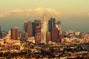
The San Gabriel mountains north of Los Angeles are part of a mountain chain that creates a jumbled undersea terrain where it meets faults off the coast.
Mark J. Terrill/AP/File
This week, talk about California's Borderland is not about Mexico or a Wild West theme park, it’s about two lengthy fault zones just off the southern coast that, scientists say, may have the potential to trigger tsunamis.
At this point, it’s unclear how large those tsunamis could be, notes Mark Legg, a lead author of a new study of the faults. But the researchers conclude that both zones have the potential to trigger quakes stronger than magnitude 7. Both appear to rupture in ways that could trigger tsunamis.
The world's largest quakes, which tend to generate tsunamis, occur along subduction zones, where one plate in Earth's crust is sliding beneath another.
The newly detailed zones are different – the faults are not as long or deep as faults along subduction zones. But the Borderland is so close to the coast "that there would still be some impact on harbors and marinas" from even a modest tsunami, says Monica Kohler, a geophysicist at the California Institute of Technology in Pasadena and a member of the team.
Undersea landslides, for which there is evidence, also could trigger tsunamis, she adds.
To some degree, the potential tsunami risk has been apparent for at least 90 years. In 1927, a magnitude 7.1 temblor occurred along an undersea fault some 10 miles west of the city of Lompoc, Calif. The temblor generated a six- to seven-foot tsunami at Pismo Beach, about 30 miles up the coast.
But understanding the tsunami risk in more detail meant understanding the sea floor in more detail.
The stretch of Borderland closest to land has been studied extensively, but the data grow more sparse with distance. In 2010, the a team of researchers that included Drs. Legg and Kohler embarked on a research cruise dedicated to filling in gaps, giving special attention to two faults, the Santa Cruz-Catalina Ridge Fault and the Ferrelo Fault. Each was known only through fragments. One of the factors contributing to an earthquake's magnitude is the length of the rupture.
The seascape in that area represents a spectacular terrain created by a jumbled geological log jam. The northwest-sliding Pacific Plate runs into the offshore roots of mountains that run east-west on the northern border of the Los Angeles Basin before plunging into the sea. These mountains are forming as the Pacific plate collides with a bend in the San Andreas Fault.
"I've seen a lot of things in my day, and just looking at the images of some of the relief that we were going over as we were crossing it was breathtaking," Kohler says.
They found that the Santa Cruz-Catalina Ridge Fault zone stretches more than 185 miles, while the Ferrelo Fault zone, farther out to sea, extends some 167 miles.
When the researchers blended the new mapping data with older data, they also found that the Santa Cruz-Catalina Ridge Fault zone hosted blocks that showed signs of uplift, even as they slide past each other along the fault. The Ferrelo Fault zone also showed evidence of vertical slip as well as horizontal slip.
The evidence of vertical motion is important because sudden vertical displacement could generate a tsunami.
The analysis, published recently in the journal Geophysical Research Journal: Earth Surface, represents an important step in characterizing the offshore earthquake and tsunami hazards southern California faces.
But more work needs to be done, the researchers say.
Mapping undersea faults requires expensive ship time and the right remote-sensing tools. Digging into the details will require manned and unmanned submersibles as well as gear to gather core and rock samples, says Legg, who heads Legg Geophysical, a geophysics consulting firm in Huntington Beach, Calif.
Task No. 1, he adds, "is to get accurate measurements of the fault slip rates."
So far slip rates have been published for only a few faults in the Borderland, including the Palos Verde and San Pedro Basin Faults, Legg says.

