Watery mission: SpaceX and NASA join forces on 2021 monitoring project
SpaceX will launch NASA's Surface Water and Ocean Topography mission. The mission will provide new data for tracking floods, droughts, and other hydrological changes.

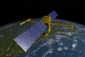
NASA's Surface Water and Ocean Topography satellite, shown here in an artist's depiction, is scheduled to launch in 2020 and will collect detailed measurements of how water bodies on Earth change over time.
Courtesy of SWOT/JPL/NASA
SpaceX and NASA will be joining forces on an unprecedented new project to map the Earth’s bodies of water, in a flight that embodies the public-private partnership the two organizations crave.
Elon Musk's Space Exploration Technologies Corporation has been selected to launch NASA’s Surface Water and Ocean Topography mission, the agency announced on Tuesday. The launch is currently planned for April 2021: a Falcon 9 rocket will carry the mission from Vandenberg Air Force Base in California into space.
The mission is “designed to make the first-ever global survey of Earth’s surface water,” according to NASA. Scientists hope the measurements it takes as it circles the globe every 11 days will help track floods, monitor droughts, and protect livelihoods.
SpaceX already works with NASA on projects like resupplying the International Space Station. Mr. Musk also called on NASA officials, among others, to help SpaceX figure out what went wrong during its explosive Falcon 9 failure back in September. The partnership between the two, as well as NASA’s cooperation with other private spaceflight companies in low-Earth orbit, is intended to allow NASA to turn its attention toward the journey to Mars – a goal Musk also shares.
In that same spirit of cooperation, the SWOT spacecraft will be jointly developed and managed by NASA and its French counterpart, Centre National d’Études Spatiales. International partners are also involved in the mission.
As it makes regular trips around the Earth, surveying at least 90 percent of the planet, the SWOT mission “will collect detailed measurements of how water bodies on Earth change over time,” according to the NASA press release. No matter how cloudy the day, it will be able to take high-resolution images.
For some bodies of water, this new information will be the only data available. For others, scientists are hoping SWOT will help deepen existing understanding. The data should improve weather forecasting in the short term, as well as long-term climate predictions.
Scientists may also be able to link changes in the slope or width of rivers to the likelihood of floods or probability of droughts, the US Geological Survey suggested. Having this data may help give early warning if people need to be evacuated or if supplies need to be brought in. It could spur policies like installing flood barriers or preventing overuse of water from overstressed sources.
The mission’s website even suggests that it could help gauge the ecological impact of hydropower installations, which is a topic of heated debate.
According to NASA, SWOT will cost the agency a total of $112 million, including the launch service provided by SpaceX, spacecraft processing, payload integration, and support for the tracking, data, and telemetry instruments.

