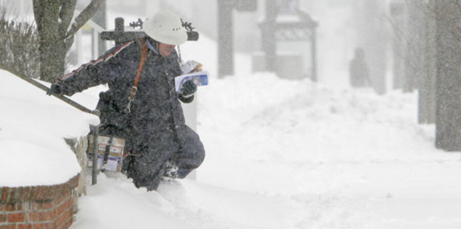
Global warming not always to blame for extreme winters
Whatever global-warming models may suggest about the futures of Earth's climate, one thing is certain: Global warming never promised to eliminate winter, especially for those living outside the tropics.
From snowballs in Baghdad to severe blizzards in China, the past three months have seen their share of extremes:
• Greece and Turkey experienced severe storms in January.
• By some estimates, the storms in China flattened about 10 percent of its forests.
• Even tropical northern Vietnam experienced a prolonged cold spell in January that sent temperatures as low as 28 degrees F.
The extremes weren't all frigid. In Stockholm, Sweden's weather service posted an average temperature of 36 degrees F. this winter, which for weather-data purposes runs from December through February. That makes it the warmest winter since 1756. In January, Australia saw its temperatures rise 2.2 degrees F. above the 1961-2000 average, a record anomaly.
In the continental United States, things were a bit more sedate, despite the tornadoes that struck the Southeast in January and the snow that piled high in ski country. This winter ranked as the 54th coolest on record, though still 0.2 degrees F. above normal, according to preliminary figures released Thursday by the National Climate Data Center in Asheville, N.C. And it ranked as the 18th wettest winter, dropping an average of 2.7 inches of moisture on the country – just over half an inch above normal.
Still, weather and climate specialists caution against using a litany of the period's frigid bluster or relative warmth to draw conclusions one way or the other about global warming.
Week in and week out, natural variations in weather "are far greater than any climate-change signal," says Michael Halpert, deputy director of the National Weather Service's Climate Prediction Center. Winter temperatures in North Dakota can range from 30 below zero F to 50 above. Against such strong seasonal temperature swings, "folks living in North Dakota aren't going to see that it's a degree warmer or a degree colder" based on long-term trends in global average temperatures, he adds.
Even when global warming becomes apparent – from decades to a century away – "winter will still happen, with cold spells and severe weather," says Gerald Meehl, a research scientist at the National Center for Atmospheric Research in Boulder, Colo. "But the trend will be toward fewer cold spells and fewer severe weather events."
From North America's standpoint, many forecasters point to La Niña, El Niño's climatological sister, as the key driver behind this past winter's offerings. Under La Niña conditions, warm water pools in the western tropical Pacific while waters in the eastern Pacific grow colder.
Typically, for the US, La Niña boosts the chances of colder-than-usual temperatures for the Northwest and warmer-than-usual average temperatures for much of the rest of the country. Also, the southern tier of the US typically is drier than normal, with wetter-than-normal conditions in the Northwest and in the Ohio River Valley.
This winter, however, failed to follow that script. The usual areas expecting moisture got it. But so did the Southwest and Southeast, which received far more snow and rain than they usually do during a La Niña event. Across the country, temperatures varied far more widely than anticipated. Just over 1,200 locations reported reaching or beating record low temperatures, while just over 4,200 reported matching or beating record highs.
As a result, forecasters didn't do too well, Mr. Halpert says. Ordinarily, forecasts are most accurate when El Niño or La Niña's effects are strongest. This time, he estimates, the seasonal temperature forecast only topped a random forecast by 10 percent to 20 percent, while the precipitation outlook beat a random forecast by some 25 to 30 percent. Seasonal forecasts are deemed a success if they beat a randomly generated forecast by 50 to 70 percent.
The fly in the ointment: another tropical pattern that is a bit like El Ni̱o on roller blades. It's called the Madden-Julian Oscillation. It starts as a large mass of rain clouds in the Indian Ocean. Then it moves east along the tropics Рweakening over land and strengthening over water Рuntil it returns to its starting point. It circles the globe once every 30 to 70 days, leading to its own wet-dry cycle.
This winter, the oscillation reinforced La Niña, Halpert says, leading to the unexpected variation in US temperatures as well as the beneficial precipitation in drought-stricken regions of the US. Indeed, he says, forecasters haven't seen this coincidence of a strong La Niña with strong Madden-Julian activity before.
At the moment, it defies forecasters, Dr. Meehl acknowledges. They can deal with it once it starts, but they don't know what triggers it in the first place. Knowing this would be very useful in making seasonal forecasts. In both the weather-forecasting and climate-modeling arenas, efforts to fix that problem represent a work in progress.


