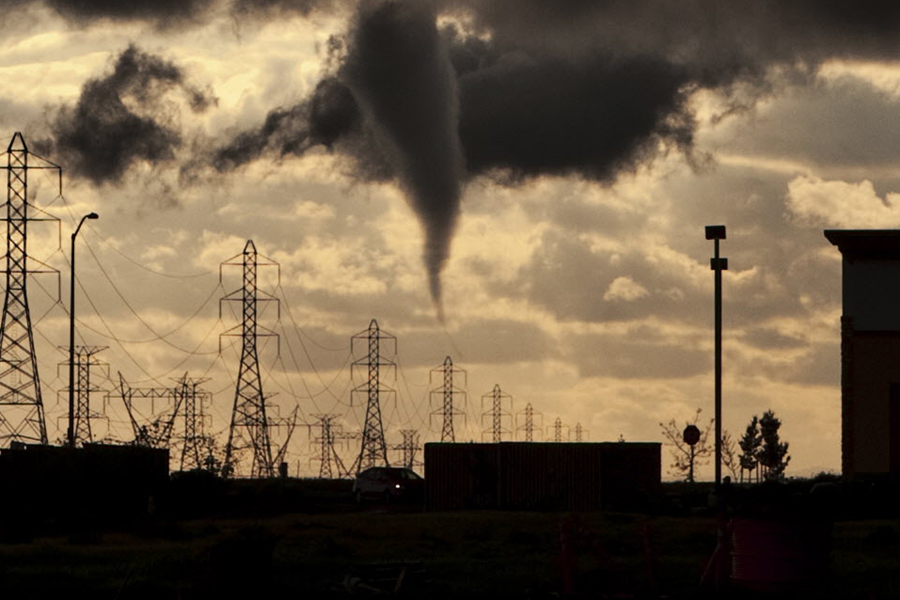
Tornadoes in California damage homes, leave trail of debris
Loading...
| SAN FRANCISCO
Tornadoes touched down during storms in Northern California, including one twister near Sacramento that damaged a dozen homes and left a path of debris about 300 yards long.
Between a dozen to 20 houses suffered roof and fence damage when a tornado hit near Roseville in Placer County shortly after 6:15 p.m. Wednesday, Rob Baquera, a fire department spokesman, said Thursday.
No injuries were reported and no residents were displaced as two families whose houses had some significant damage were able to remain at home, Baquera said. The path of debris extended more than 100 yards, with a width of 10 to 20 yards as it rolled through the northwest part of town, he said.
"We're in a bit of recovery mode right now as there were a few people a bit shaken up as they saw the cloud roll over them," Baquera said. "We're fortunate that everybody did the right thing by seeking shelter in place when the tornado struck."
A tornado also touched down in Ordbend, in Glenn County, the weather service said. There were reports of at least four twisters, which are rare for California.
"The tornadoes which do occur are created by systems coming off the Pacific and are generally much weaker than those experienced by the Plains, as was the case here," Michael Palmer, lead meteorologist at The Weather Channel, told KNTV.
Northern and Central California were drenched and wind-whipped by wild weather that brought thunderstorms and hail.
Heavy rain hit morning commuters in San Francisco but by the end of Wednesday only about a half-inch of the much-needed rain had fallen.
Other northern and central areas generally saw a quarter- to a half-inch, with an inch recorded in a few places.
"Finally we're getting some rain," San Francisco resident Mike Vladimer told KGO-TV (http://bit.ly/P3IXM9). "We need it. It's been really dry."
San Francisco has received less than half of its average rainfall since last summer.
"So, I know people hate the rain here and I'm very not used to it," Vladimer said. "But at the same time, I've seen how low the water levels are. So hopefully this is getting over the mountains and into the reservoirs."
The north was in the midst of what forecasters were predicting would be the longest stretch of wet weather yet this year for the state suffering through a drought.
Showers were likely to continue through the weekend, especially from Friday afternoon through Sunday morning when the Sacramento Valley could get another half-inch to more than an inch of rain. The southern Bay Area could see up to a half-inch of rain, and the northern Bay Area could get as much as 1 to 2 inches, said Holly Osborne, a meteorologist with the weather service in Sacramento.
The Sierra Nevada could receive 1 to 2 feet of snow above 7,000 feet.
But the showers might not end with the weekend, Osborne said.
"We're expecting unsettled weather even into early next week, so be prepared to bring your umbrella and rain boots," she said.


