Fine art of hurricane tracking: Push is on for the 7-day forecast
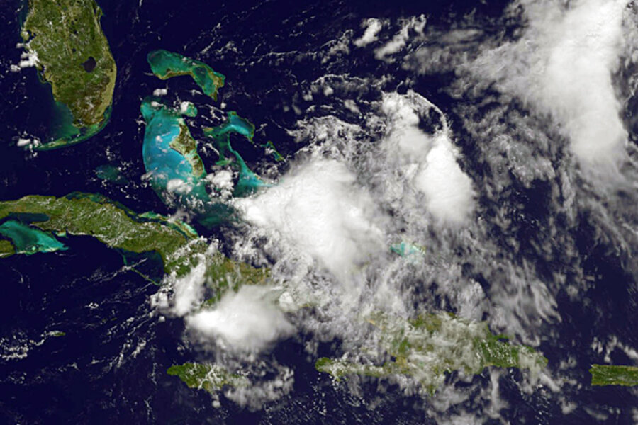
For several days, forecasters at the National Hurricane Center in Miami had been monitoring a broad patch of storms developing in the far eastern Caribbean. The key question: Would it blossom into a tropical storm?
At 7:35 p.m. on Aug. 1, forecasters announced that what had been a disorganized system 24 hours before had quickly become the season's fifth tropical cyclone, Emily. Tropical-storm warnings were promptly posted for nearby islands, but the lead time for locals was virtually nil.
Emily's relatively quick shift from a jumbled collection of storm clouds to an organized tropical storm highlights a pair of intricate puzzles that scientists – armed with fresh data, upgraded forecasting models, and a storm-chasing drone – are pushing to solve: How can they identify the storm systems most likely to organize into tropical cyclones, and how can they better forecast when a storm is about to suddenly intensify?
The first question is central to the National Oceanic and Atmospheric Administration's (NOAA) attempts to develop seven-day storm-track forecasts – up from five days, currently. And the second is crucial to making sure a storm doesn't pack a surprise when it is about to make landfall. Together, the two agency priorities could significantly aid preparedness in the United States.
Already, research over the past 30 years has helped forecasters cut the errors in track forecasts by 50 percent, says Frank Marks Jr., who heads the hurricane-research division at the NOAA Atlantic Oceanographic and Meteorological Laboratory in Miami.
Using 2008 forecasts as the benchmark, the goal now is to reduce these errors by 20 percent in five years and by 50 percent in 10 years. But to provide emergency managers with guidance up to seven days out, forecasters are going to have to know which patchwork of storm clouds to track even before they become a tropical cyclone, Dr. Marks says.
And that means understanding storms such as Emily.
"If you're going to look at a system spin up in the Caribbean and potentially make landfall in the US in three or four days, you've got to do genesis," he says, referring to understanding a storm's evolution from whisper to roar.
To do that, three separate but related field campaigns sent researchers and NASA's Global Hawk drone around, through, and over several storms last year to study them frequently through their evolution. For instance, researchers measured hurricane Karl on 20 missions throughout its evolution from a disheveled mass of storm clouds south of Jamaica to a Category 3 hurricane, with top sustained wind speeds of 125 miles an hour. The storm hit Veracruz, Mexico, as a Category 2 – the strongest to hit the city on record.
From a storm "genesis" standpoint, data from Karl may be a gold mine, says Ed Zipser, a researcher at the University of Utah. He notes that scientists were able to fly through the system for four days before it strengthened enough to reach tropical-storm status.
But those first four days present a puzzle. During that period, the stormy region that would become Karl had all of the conditions necessary for a system to organize and strengthen: warm seawater at the surface; a vigorous preexisting weather disturbance; weak changes in wind speed and direction with altitude; lots of moisture in the air; and lots of towering, thunderheadlike clouds dumping heavy rain.
Yet only on the fifth day did the storm cross the tropical-storm-to-cyclone threshold. Before that, the storm alternated between day-long flare-ups and day-long interludes, says Dr. Zipser. The data that tracked this phenomenon, he says, may hold clues to subtler factors that must be present for a storm to earn a name.
To continue looking for these clues, NASA is funding scientists to deploy two of its Global Hawks – which can reach altitudes of 55,000 feet and stay airborne for some 30 hours, gathering key information on a storm for far longer and far more frequently than satellites or piloted aircraft. The three-year program begins next year.
A key piece of information the drones are likely to hunt for: the status of ice crystals in the thunderheads near a storm's center. Changes in the concentration of ice crystals high in these clouds could signal the coming of a rapid increase in intensity, recent research suggests.
Why ice crystals?
The more ice high in these clouds, the stronger the updrafts pulling warm, moist air from lower altitudes to feed the storm. From a bird's-eye view, this ice buildup looks like a bright ring around storm centers just before rapid intensification.
University of Illinois atmospheric scientist Stephen Nesbitt and graduate student Daniel Harnos conducted a systematic search of microwave data from satellites from 1987 through 2008 and found many more examples. A ring formed about six hours before a storm underwent rapid intensification. Then, as a storm continued to intensify, the ring tightened.
They also found that this signal in the ice crystals came in two forms, depending on the broader atmospheric conditions a storm was encountering.
The data could lead to a new tool for predicting rapid intensity changes within the next two years, Mr. Nesbitt says.


