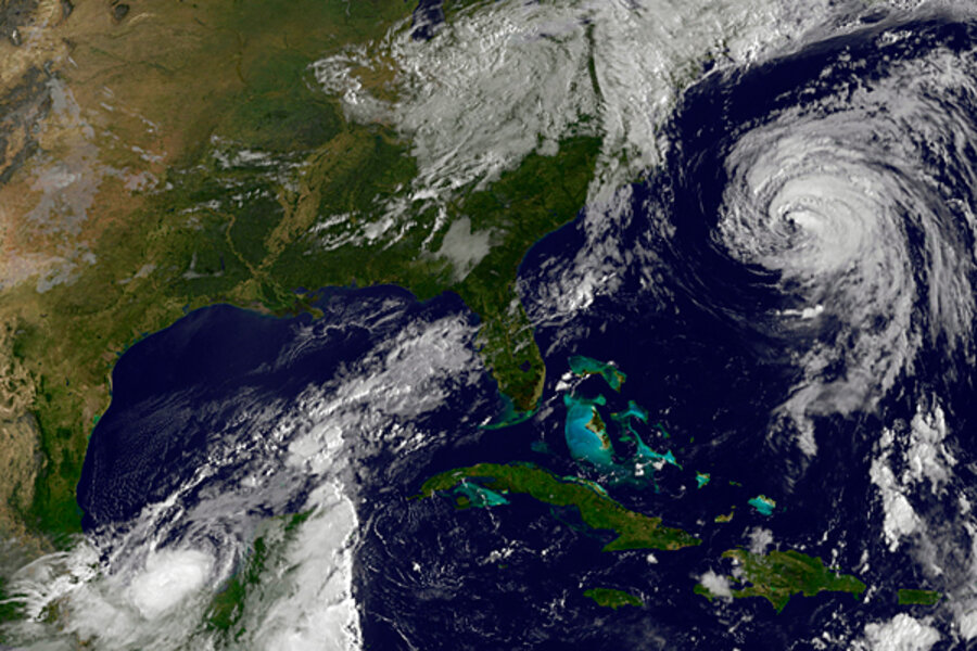
As Katia blows by the East Coast, Nate and Maria are brewing in tropics
Loading...
Hurricane Katia, currently spinning northward some 453 miles east of Wilmington, N.C., is nothing if not well traveled.
Beginning as a mass of storm clouds south of the Cape Verde Islands on Aug. 29, Katia swept across the Atlantic to begin tracing an arc along the North American East Coast.
By next Tuesday morning, track forecasts show the storm splitting the uprights between the northern tip of Scotland and the Faroe Islands. Next stop, Norway?
Although Katia will have lost its name and tropical nature by then, forecasters note it should still be a potent North Atlantic storm system – an extratropical cyclone – packing winds of nearly 70 miles an hour.
"It's not out of the norm at all" for still-powerful hurricane remnants to work their way toward the United Kingdom and northern Europe, notes Dennis Feltgen, a spokesman for the National Hurricane Center in Miami. Storms that originate off the Cape Verde Islands, as Katia did, generally tend to "make the big loop-around."
Even the odd Caribbean-born storm can wind up knocking on Scotland's door. In 2006, tropical storm Alberto formed in the northwestern Caribbean and made landfall along the Florida Panhandle. It weakened, swept across Georgia and the Carolinas, then headed out over the Atlantic as an extratropical cyclone to the land of kilts and haggis.
As for Katia, it's main threat to the East Coast comes in the form of high surf and powerful coastal rip currents, forecasters say.
Of more immediate landfall concern is tropical storm Maria, 660 miles east of St. Lucia in the Lesser Antilles. Local forecasters have posted tropical storm watches along much of the island chain, meaning residents should expect tropical storm conditions within 48 hours. The latest forecast puts Maria on a path similar to Irene's, with the storm tracking just west of the Bahamas early next week.
Maria's maximum sustained winds are expected to remain within tropical-storm range – from 39 to 73 miles an hour – through next Tuesday, although the storm is projected to strengthen within that range over the period.
Meanwhile, to the west, tropical storm Nate is presenting a ticklish forecasting challenge.
Nate currently is located some 250 miles east of Veracruz, Mexico. The latest track forecast would appear to put Nate about 200 miles southeast of Brownsville, Texas, by next Tuesday. But forecasters note considerable uncertainty in that track, with some models sending Nate toward toward the northern Gulf coast while others indicate a turn toward Mexico. Much hinges on how Nate interacts with circulation patterns governing a weather system taking shape over the Ohio Valley.


