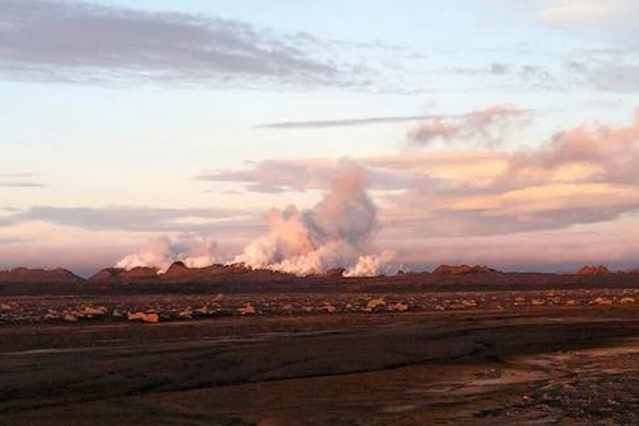
Lava erupts from Iceland's Bardarbunga volcano
Loading...
Lava is streaming from an eruption north of Iceland's Bardarbunga volcano, the Icelandic Met Office has confirmed. Magma broke through a rift in an older lava flow around midnight local time (about 8 p.m. ET).
The new fissure is 0.6 miles (1 kilometer) long, according to early estimates. The lava field is 5.5 miles (9 km) north of Dyngjujokull glacier, in a region between Bardarbunga volcano and the nearby Askja volcano. Scientists monitoring Bardarbunga's activity are camped near the eruption and confirmed the fiery lava has emerged. Small lava fountains and an orange glow also appeared on the region's live webcams here andhere.
Bardarbunga volcano is now at red alert, diverting planes around the area above the eruption. There is no ash cloud from the eruption at this time. Officials also raised Askja volcano to yellow alert. The area around the eruption has been closed to visitors since an earthquake swarm first shook the volcano on Aug. 16. [Gallery: Iceland's Booming Bardarbunga Volcano]
Askja volcano is 30 miles (50 km) northeast of Bardarbunga. Molten rock is tunneling sideways underground toward Askja from Bardarbunga. The narrow magma intrusion, called a dike, is about 25 miles (40 km) long.
As the leading edge of the dike pushed upwards toward Holuhraun Wednesday (Aug. 27), new cracks appeared on the surface and older fractures in the lava flow expanded, the University of Iceland reported. Holuhraun is a lava flow that erupted in 1797.
Scientists from the Icelandic Met Office and the University of Iceland are closely monitoring activity in the region. Officials flew over the Bardarbunga area on Thursday (Aug. 28) to check for signs of subglacial eruptions. The glacier blanketing Bardarbunga volcano has cracked and sunk over the southeast corner of the caldera rim, a sign of melting underneath the ice.
Three circular crevasses were discovered yesterday during an afternoon reconnaissance flight. Each pit is about 32 to 50 feet (10 to 15 meters) deep and altogether, they form a line about 3 miles (5 kilometers) long.
The meltwater appears to have flooded Grimsvotn Lake, south of Bardarbunga, the IMO said. The lake level has jumped about 16 to 32 feet (5 to 10 m) since its last measurement.
Bardarbunga volcano is buried under the northwestern edge of the huge Vatnajökull ice cap. Scientists must monitor earthquakes, changes in water levels and the glacier's surface to detect a subglacial eruption. The ice in this area is about 1,310 to 1,970 feet (400 to 600 m) thick.
Email Becky Oskin or follow her @beckyoskin. Follow us @livescience, Facebook & Google+. Original article on Live Science.
- In Photos: Aftermath of Iceland Volcano Floods
- Big Blasts: History's 10 Most Destructive Volcanoes
- Iceland Volcano's Fiery Sunsets
Copyright 2014 LiveScience, a TechMediaNetwork company. All rights reserved. This material may not be published, broadcast, rewritten or redistributed.


