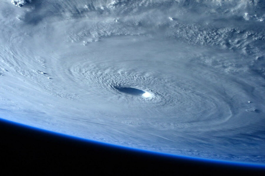
Extraordinary photos of mega Typhoon Maysak
Loading...
From afar, even the deadliest weather events can be a stunning sight.
Italian astronaut Samantha Cristoforreti proved it Tuesday with photos of Super Typhoon Maysak, taken from aboard the International Space Station. The images of the storm as it carves a northwest path across the Pacific Ocean, through Micronesia, and towards the Philippines give a breathtaking glimpse of the awesome power of nature.
“Commands respect even from space,” Ms. Cristoferreti tweeted along with one of the pictures.
Down on Earth, storms like Maysak inspire more dread than awe.
A typhoon begins life as a tropical cyclone: “A rotating, organized system of clouds and thunderstorms that originates over tropical or subtropical waters and has closed, low-level circulation,” according to the National Oceanic and Atmospheric Administration (NOAA).
When a tropical cyclone reaches maximum sustained winds of 74 miles per hour, it then becomes classified as either a hurricane, if it occurs in the Atlantic and northern Pacific; a cyclone, if it occurs in the Indian Ocean and south Pacific; or a typhoon, if it’s in the northwestern Pacific.
The Saffir-Sampson Hurricane Wind Scale, developed by wind engineer Herb Saffir and meteorologist Bob Simpson in the late 1960s, is a 1 to 5 rating based on a hurricane’s (or cyclone’s, or typhoon’s) sustained wind speed.
Winds of 74 to 95 miles per hour classify as Category 1, 95 to 110 miles per hour as Category 2, and so on. A Category 5 carries winds of above 157 miles per hour – fast enough to rip off roofs, demolish homes, cause long-term power failure, and render an area uninhabitable for weeks or months, according to NOAA.
Hurricanes and typhoons can also be analyzed using the Dvorak technique, a method that determines sea surface and cloud temperatures using infrared and satellite imagery. Named after Vernon Dvorak, who developed it in the 1970s and 80s, the technique is used by analysts and computers to help estimate the intensity of a storm.
“It’s basically an inkblot test for hurricanes,” James Franklin, chief of the hurricane specialist unit at the National Hurricane Center, told The New York Times. “You can relate the appearance of the storm to intensity.”
Earlier this week, Maysak reached wind speeds of up to 160 miles per hour and was initially labeled a Category 5, Weather.com reported. The typhoon caused significant damage and killed 5 people as it made its way through an island in the Federated States of Micronesia, according to The Associated Press.
Winds have since dropped slightly, but in the Philippines, where Maysak is expected to make landfall Sunday or Monday, the government has issued a warning to tourists who have flocked to popular spots across the Southeast Asian nation ahead of Easter weekend, according to Reuters.


