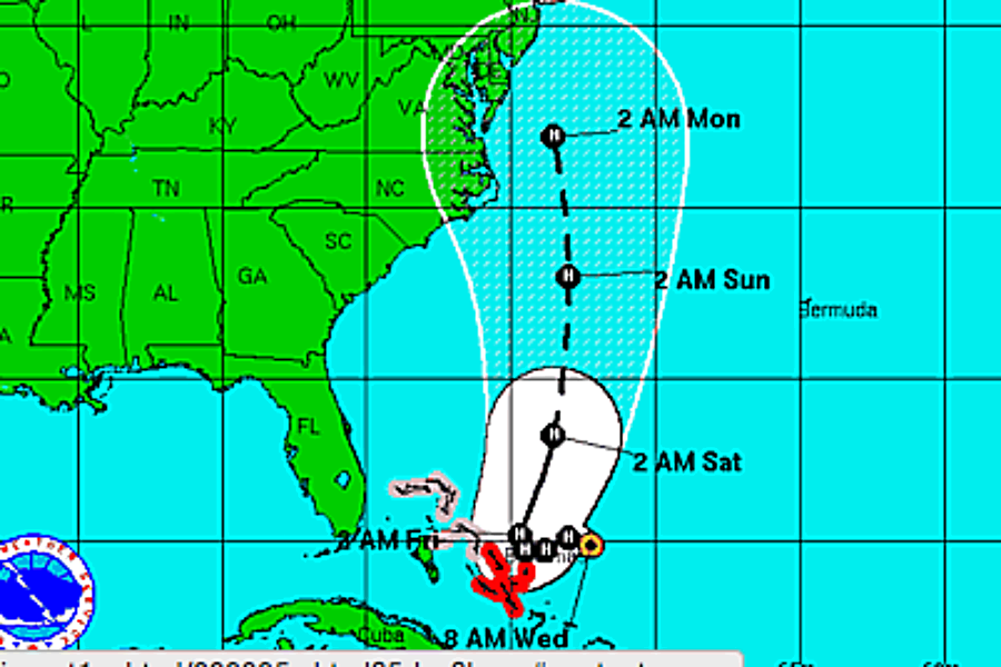
Hurricane Joaquin: Where's it headed?
Loading...
| Miami
Joaquin strengthened to a hurricane Wednesday morning as it nears the Bahamas.
A hurricane warning has been issued for the central Bahamas as the storm approaches.
Hurricane Joaquin's maximum sustained winds increased to near 75 mph (120 kph). The US National Hurricane Center says additional strengthening is expected over the next two days.
Conditions are expected to be conducive for intensification during the next few days, with Joaquin moving over very warm waters with shear steadily decreasing. The hurricane intensity guidance and the latest runs of the GFS, UKMET, and ECMWF all show Joaquin intensifying, and in fact, the global models show the central pressure in the 950s or lower. The NHC forecast is near the latest intensity model consensus, and has Joaquin peaking in 72 hours. After that time, the cyclone will be moving into a higher shear environment and over cooler waters, which should result in slow weakening.
The storm is centered about 245 miles (395 kilometers) east-northeast of the central Bahamas and is moving southwest near 6 mph (9 kph). Joaquin's center is expected to pass over or near the central Bahamas Wednesday night or Thursday.
The National Hurricane Center notes that the computer models have little agreement on the path over the next few days:
Confidence in the details of the track forecast late in the period remains very low, since the environmental steering currents are complex and not being handled in a consistent manner by the models. Given that a wide range of outcomes is possible, it is too soon to say what impacts, if any, Joaquin will have on the United States.
Meanwhile in the Pacific, Marty has weakened to a tropical depression as it moves away from Mexico's coast.
Marty's maximum sustained winds have decreased to near 35 mph (55 kph) and it's expected to weaken to a remnant low later Wednesday or on Thursday. The depression is centered about 115 miles (185 kilometers) south-southwest of Zihuatanejo, Mexico.


