Hurricane Sandy is already setting records
Hurricane Sandy is working its way up the US East Coast, yet even before it moves ashore it's a storm for the record books.
The storm already has surpassed hurricane Lili in 1996 as the second largest Atlantic storm in 24 years of storm-size recordkeeping. Using tropical-storm-force as the benchmark, such winds briefly extended up to 520 nautical miles from Sandy's center earlier on Sunday. The latest advisory puts that figure at 450 nautical miles, while hurricane-force winds extend up to 175 nautical miles.
At landfall, currently forecast for overnight Monday or early Tuesday morning, the atmospheric pressure at the center of the storm – a measure of Sandy's intensity – is expected to fall within a range that ultimately could match the devastating hurricane of 1938, notes Jeff Masters, director of meteorology for the Weather Underground.
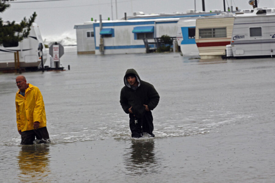
The size of the storm and its path, which currently has Sandy's center beginning its sharp turn for the New Jersey coast Monday morning, are intensifying already deep concerns about coastal flooding from storm surge.
Sandy "is going to produce very high, potentially life-threatening storm surge … that may require additional evacuations today," said Craig Fugate, administrator of the Federal Emergency Management Agency (FEMA) during a press briefing Sunday.
The combined water height from storm surge and high tide is expected to range from 4 to 8 feet above ground level along a stretch of coast running from Ocean City, Md., to the coasts of Connecticut and Rhode Island, according to Richard Knabb, director of the National Hurricane Center in Miami.
But, he adds, hot spots along the coast – Long Island Sound, New York Harbor, and Raritan Bay, for instance – could see surges of from six to 11 feet. Surge forecast maps from the National Hurricane Center and the Ocean Prediction Center point to a surge of at least three feet perhaps working its way up the Hudson River as far as Albany, N.Y. The coastline from New Jersey to Massachusetts' Cape Cod forms a funnel that will receive water the spinning storm's winds have swept around from its southwestern flank. Raritan Bay, New York Harbor, and western Long Island Sound form the pointy end of the funnel.
Storm surge does not take into account the height of waves that the storm whips up atop the surge. Moreover, forecasters are concerned that surge levels and pounding surf will remain high over several high-tide cycles.
The notion of surge "hot spots" highlights a point that can get lost in the impressive storm-scale numbers: While the storm will affect tens of millions of people, those effects will vary in intensity and composition.
"When you deal with an area that's basically from North Carolina all the way up to Maine, and inland to West Virginia to the Ohio Valley, not everyone is going to have the same impact," FEMA's Mr. Fugate says.
For instance, because Sandy is merging with a mid-latitude storm system that has cold air filling in behind it, the combined effects of both are expected to bring snow to West Virginia, while bringing lesser amounts to eastern Kentucky, western Virginia, and even into North Carolina, notes Louis Uccellini, who heads the National Centers for Environmental Prediction in College Park, Md.
"We're looking at a potential for two feet or more" in some areas of West Virginia, "so this is going to be a substantial snow event," he says.
Indeed, the system bringing the cold air is expected to continue its march east as Sandy merges with it and weakens, with nighttime temperatures ranging from the mid 20s in the mountains to the 30s and low 40s along the coast. The low temperatures are a concern in the face of widespread power outages expected as Sandy's hurricane- and tropical-storm-force winds meet rain-sodden trees still flush with leaves.
According to the national Hydrometeorological Prediction Center, also in College Park, over the course of the next five days, the heaviest rainfall from the storm as it makes landfall, then quickly weakens, will be in the land-fall area. There, forecasters expect rainfall to range from 4 to 8 inches, with some isolated spots receiving as much at 12 inches. From southern New York State into New England, rainfall is expected to range from one to three inches, although some spots could see up to five inches.
Overall, while significant flooding and even flash floods are expected throughout the region, catastrophic flooding is less likely, Dr. Masters suggests, given low levels of moisture already in the soils around the region where Sandy is expected to make landfall. Heavy flooding during hurricane Irene last year resulted in no small part because the storm's torrential rains fell on ground already saturated by a series of storms that had rolled across the eastern US in the weeks before Irene arrived.
For the duration, the National Hurricane Center's Dr. Knabb is urging people to check with their local National Weather Service Forecast offices for information on Sandy's local impact.
With the storm centered some 200 miles southeast of Cape Hatteras, tropical-storm-force winds already are reaching the southern Chesapeake Bay.
"The time for preparing and talking is about over," Fugate says. "People need to be acting now."


