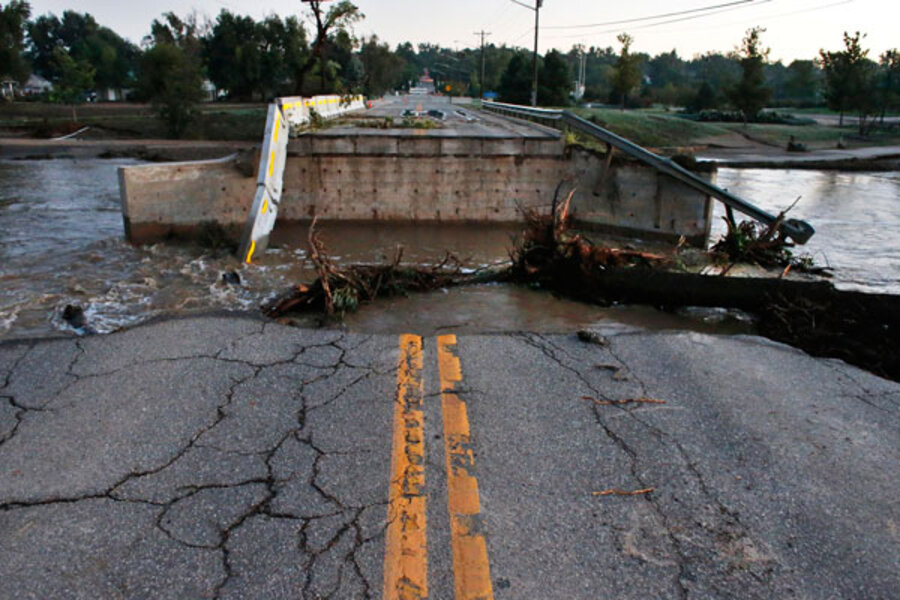
For Colorado's 'biblical' floods, numbers tell astonishing tale
Loading...
| Boulder, Colo.
As the floodwaters begin – slowly – to recede in waterlogged Colorado, officials are beginning to assess damage and take stock of the extent of the damage and the size of the rebuilding that lies ahead.
It may be weeks, or even months, before the full extent of the size and cost of the destruction is known. In the meantime, though, here are several statistics that give some sense of just how damaging – and unusual – these floods were.
Rainfall. It’s hard to know which numbers to use to convey just how totally every previous record was shattered by the amount of rain in Boulder. In just one day, 9.08 inches of rain fell. Prior to last Wednesday, the single-day record was from 1919, when 4.8 inches of rain fell. Between Monday and Friday last week, some 15 inches fell – doubling the previous record of rain from a single storm: 7.37 inches of rain in May of 1969. Boulder has already set a record for the most yearly rainfall (30.13 inches), and there are 3-1/2 months remaining in the year.
The records are even more extreme when you consider that September is normally one of the drier months in Colorado. Typically, Boulder gets about 1.5 inches of rain in September. The record before now was 5.5 inches, set in 1940. To date this month, the town has seen 17.17 inches, and there are still 12 days left.
All of which is to say: It has been a wet month. And the statistics are so unusual that they have many officials referring to the flood – at least in places – as a thousand-year flood rather than a hundred-year flood (meaning that, in any given year, it has about a 0.1 percent chance of occurring).
Size of the flooding. Major flooding has affected 17 counties, covering a north-south swath 200 miles long. It has stretched from the foothills west of Boulder and the mountain town of Estes Park to towns like Sterling, 140 miles east of Boulder, which was just beginning to flood on Monday as the South Platte River crested. By Wednesday, the flooding was spreading into Nebraska.
Some estimates have put the scope of the flooded area at about 4,500 square miles – or roughly the size of Connecticut.
The Big Thompson River exceeded record flood stage for 60 hours. In Boulder, the Boulder Creek was running at 54 cubic feet per second last Monday, Sept. 9. By the height of the flood Thursday night, it was running at 5,000 cfs.
The displaced. Statewide, 12,118 people are under mandatory evacuation orders. The biggest airlift operation since hurricane Katrina helped evacuate more than 1,000 residents in remote mountain towns that had been completely cut off due to washed-out roads. Fourteen shelters are currently operating, housing nearly 500 people.
There are at least six confirmed fatalities due to the flood, and two more people in Larimer County are missing and presumed dead.
The destruction. Initial figures from the Colorado Office of Emergency Management say that 1,502 residential structures were destroyed and 17,494 were damaged. Those totals are almost certain to rise.
It’s even harder to quantify how many roads and bridges have been damaged or completely washed away.
According to the Colorado Department of Transportation, at least 30 bridges were completely destroyed and another 20 seriously damaged in the flood. Those figures refer to state-maintained bridges, and Colorado Gov. John Hickenlooper has said that the number of destroyed bridges is more likely between 80 and 100.
No figures have been given yet on the miles of roadway damaged, but nearly all routes leading from Boulder into the mountains are now cut off, and lengthy sections of major canyon roads – including US 34 and 36, Colorado 7, 14, 72, and 119 – have been shut down for the foreseeable future.
Federal officials have put preliminary estimates on the cost of repairing infrastructure at $40 million for roads and $112 million for bridges.


