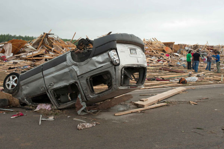
Tornado damage: why it's so hard to predict monster twisters
Loading...
The largest and most devastating tornado spawned from the storm system that raked parts of the South and Midwest overnight was a half-mile wide and cut a 30-mile path across Arkansas, meteorologists say.
In all, 30 tornadoes were reported in seven states, and more could form Monday as the system moves into parts of Mississippi, Alabama, and Tennessee.
The potential for last night's storms to form tornadoes was forecast five days ago, highlighting improvements to tornado prediction. Yet forecasting the power and magnitude of tornadoes remains a challenge. The unpredictability of conditions that drive "super tornadoes" means that meteorologists are usually able to give residents only a few hours' warning.
"We have very little ability to forecast ahead of time whether a particular storm will make a skinny tornado or a wide tornado," says Joshua Wurman, president of the Center for Severe Weather Research, an independent, nonprofit research facility in Boulder, Colo., funded by the National Science Foundation. "We also can’t forecast if it'll be short- or long-lived."
"But we can know the combination of meteorological factors that are likely to be favorable for stronger tornadoes," he adds.
The twister that hit both Vilonia, Ark., and Mayflower, Ark., was large, but far from record-setting. The largest tornado on record is one that hit El Reno, Okla., last May, which was 2.6 miles wide and stayed on the ground for 16.2 miles.
At least 18 people were killed Sunday when tornadoes ripped houses off their foundations and flipped over vehicles, including 18-wheeler trucks, trapping some people inside. At least 100 people were injured in Arkansas, according to Reuters, and more than 10,000 people were left without power in that state.
Mr. Wurman warns that measuring the width of a tornado is “pretty subjective.” While there may be evidence of damage on the fringes, that width may exaggerate the tornado's maximum power, which might have been much more concentrated.
The conditions that create a “super tornado” include warm and humid air on the surface and frigid temperatures shooting down from at least 20,000 feet. Added to that is warm wind churning up from the Gulf of Mexico hitting the jet stream from the west, causing “the entire thunderstorm to rotate, and when that rotation is so great, it can’t contain itself and spreads out horizontally,” says Mike Smith, senior vice president of AccuWeather Enterprise Solutions in Wichita, Kan.
The nature of these variables meant the National Weather Service was unable to warn of the potential severity of the storms until 3 p.m. local time Sunday, just hours before touchdown, says Wurman.
“What we can’t tell is if, within a bunch of different storms, which one could potentially make a tornado of that force," he says. "Our ability to forecast those very important details is very low.”
The National Weather Service has issued a tornado warning until 6 p.m. local time in three Mississippi counties, with flash flood warnings in 11 counties. Heavy rain is expected through Tuesday.


