Don't put your hat away: Polar vortex bringing more cold to US
Loading...
Hold onto your ski hats, another arctic freeze is on the way.
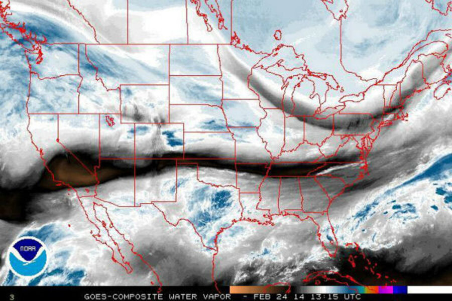
Much of the Northeast and Midwest spent the weekend basking in unseasonable temperatures that reached into the 50s in Philadelphia, New York, and Boston and even the 60s in Washington. But the polar vortex, which once again dipped into the northern Plains Monday, threatens to plunge the entire northern third of the United States into bitter cold throughout the week.
“This is going to be another dangerously cold air mass and it's coming in waves, so each day [is] just getting a little bit colder and colder as the fresh batch of arctic air is going to continue to push south and east,” reports AccuWeather meteorologist Andrew Baglini.
Yes, the cold snap is once again the product of the now-infamous polar vortex, a mass of very cold air that is held in place by the polar jet stream. This year, a weakened jet stream has allowed the vortex to expand farther south than is typical.
The polar vortex will tighten its grip on the Upper Midwest, Great Lakes, and St. Lawrence Valley Monday night and Tuesday, with wind chills ranging from 0 to minus 40 degrees F.
"The fresh supply of Arctic air should keep temperatures below normal," according to a forecast from the National Weather Service, "and portions of the Northern Plains and Upper Midwest could see readings in excess of 20 or 30 degrees below normal."
Wednesday could bring snow to Washington, New York City, and Boston, AccuWeather predicts, although accumulation is expected to be minimal.
By Thursday night, temperatures in Chicago and Detroit may plunge well below zero and may not let up until well into next week.
While the northern portions of the country contend with frigid temperatures, much of the South could be doused in thunderstorms.
The subtropical jet stream is expected to carry thunderstorms from the Pacific Coast into the Deep South, AccuWeather’s Alex Sosnowski reports. The majority of these storms are not predicted to be severe, although there could be an exception.
"You have to watch the upper-level steering winds. If these winds begin to buckle and the northern and southern branches phase, then a stronger storm may come about that tracks farther north with heavy precipitation," AccuWeather meteorologist Brett Anderson told Mr. Sosnowski.
When the polar vortex dipped well into the South last month, it brought debilitating storms. But Southerners may be spared this latest spate of cold weather, although there is a small chance that parts of southern Appalachia could see some flakes on Tuesday.
"As a storm moves from the Tennessee Valley to the mid-Atlantic coast, enough cold air may be in place to bring some snow or a wintry mix to the southern Appalachians to parts of northern North Carolina and Virginia Tuesday night," AccuWeather meteorologist Mark Mancuso said.


