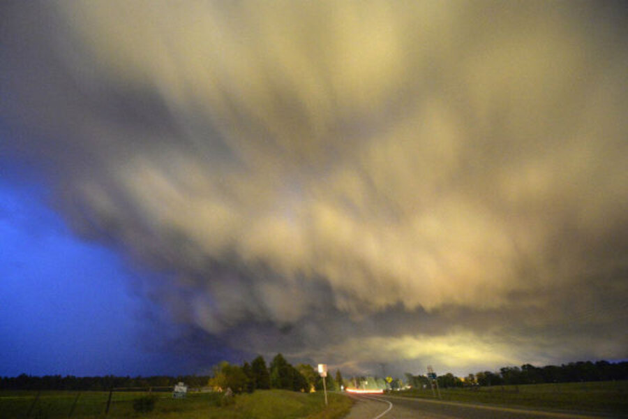
Spectacular Wyoming cloud formation: What is a supercell, anyway?
Video footage of a massive cloud formation in Wyoming has brought the breathtaking splendor of the high Plains to the desktops of millions.
The spiraling mass of clouds caught on tape by a group of storm chasers known as Basehunters shows the time-lapse formation of a supercell storm.
Supercells form when winds aloft cross surface winds, creating a powerful rotating updraft that whips clouds into a thunderous vortex, according to The Weather Channel. These formations are often referred to as “mothership” clouds because they frequently resemble an enormous space ship hovering above the earth.
The Monitor’s Pete Spotts reported on supercells for a 2012 cover story on tornadoes.
Supercells rely on four basic ingredients to form: a source of warm, moisture-laden air near the ground and colder air at higher altitudes; a shift in wind speed or direction with altitude – known as wind shear – within a few thousand feet of the ground; something to trigger the rise of that low-level warm air; and a landmass that is closer to its hemisphere's pole than the source of the warm, moist air.
These ingredients are present elsewhere, such as South America, southeastern China, Bangladesh, and on the Tibetan Plateau, notes Paul Markowski, an associate professor of meteorology at Pennsylvania State University in State College. "But no place do these conditions occur on as vast a scale as the Great Plains of the United States," he says.
The footage of the gathering storm may be a visual treat for those watching from the comfort of their desks, but supercells can be extremely dangerous for those on the ground. According to the National Oceanic and Atmospheric Administration, windspeeds within and prodtruding from supercells can exceed 100 miles per hour and are capable of producing violent tornadoes.
The supercell captured in the Basehunters' footage produced hailstones the size of baseballs. A supercell was responsible for the formation of the devastating tornado that ripped through Moore, Okla., on May 20, 2013.
Depending on moisture levels and the orientation of the updraft, these monstrous clouds can assume forms so magnificent that people who manage to capture images of them tend to want to share them. Here are a handful of recent shots from around the globe of supercells in all their glory.


