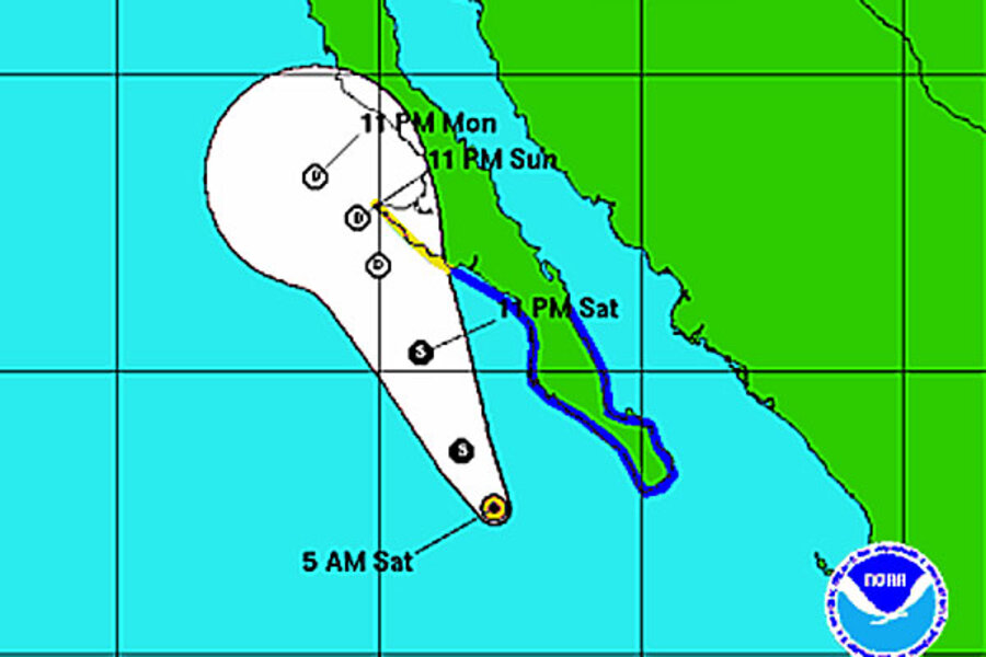
Tropical storm Ivo warnings for Baja California
Tropical storm Ivo is prompting tropical storm warnings along the Pacific Coast of Mexico.
While Ivo spans a large area, it is expected to remain a tropical storm - with winds that won't reach hurricane speed - and even weaken during the next 12-24 hours, according to the US National Hurricane Center computer models.
At 11 a.m. EDT, Ivo had sustained winds of 45 m.p.h., was located southwest of Baja California, and moving at 12 m.p.h. But Ivo has a wide girth with winds extending 195 miles from its center.
The Mexican government has issued a tropical storm warning for the Pacific coast of the peninsula from Punta Abreojos to Cabo San Lucas, and for the Gulf of California coast of the peninsula from Loreto southward to Cabo San Lucas, according to the Associated Press.
The National Hurricane Center warns that "tropical storm conditions are occurring over the southern Baja California peninsula and are expected to spread northward today within the warning area. Tropical storm conditions are possible in the watch area by tonight. Tropical storm Ivo is expected to produce total rainfall accumulations of 1 to 3 inches, with possible isolated maximum amounts of 5
Inches across the southern and central portions of the Baja California peninsula."
While the center of Ivo will likely stay off shore, rain is forecast to spread inland across northwestern Mexico and the southwestern US. The US National Weather Service warns of the possibility of heavy rains and flash flooding in the next couple of days.
Swimmers and surfers along the Baja California coast are warned that Ivo will produce high waves, including rip-current conditions.


