The geology underlying the devastating Haiti earthquake
Loading...
| Boston
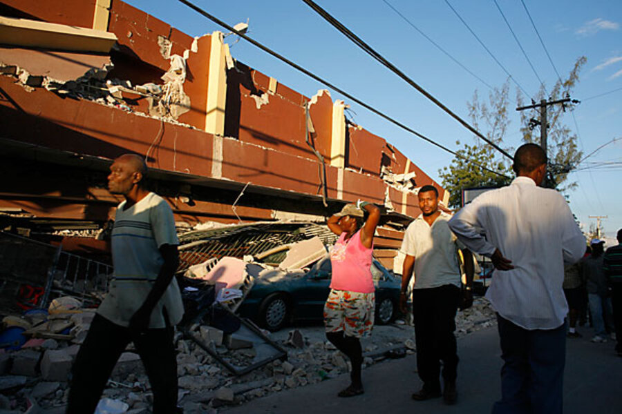
The magnitude 7 earthquake that leveled much of Haiti's capital Tuesday – the strongest temblor to hit the country in some 200 years -- may have increased strain on a segment of the same fault that lies across the border in the Dominican Republic.
That concern, based on calculations made during the first 24 hours after the quake hit, may ease with additional on-the-ground data, cautions Purdue University geophysicist Eric Calais, who has spent years studying faults on Hispaniola, the island both countries share.
But since the mid-1980s and the advent of precision satellite measurements of ground movement, plus other high-tech advances, earth scientists have developed an increasing respect for the ability of the slip of one fault to increase the strain on other, nearby faults, or on a different segment of the original fault.
In any effort to track changes in strain, "I would focus on the eastern termination of the fault towards the Dominican Republic, pending more information," he says. The reason: The rupture slid to the east. While strain would build at both ends of the ruptured segment, another rupture farther to the west would occur in a sparsely populated, hard to reach portion of Haiti. To the east, however, the fault traces a path through the mountains separating Haiti from the Dominican Republic and into the more-heavily populated southwestern portion of Haiti's neighbor.
Already, teams of researchers are planning to visit the stricken area to take the full measure of the quake before erosion or rebuilding efforts erase key pieces of evidence.
"A lot of the data we need to collect are pretty ephemeral," says Carol Prentice, a US Geological Survey researcher who is part of a relatively small group of scientists who have studied the area.
Accurate measurements of ground movement -- seen in offset stream beds or displaced roads, for instance -- help establish the amount of strain released. Careful monitoring of the strongest aftershocks, which can die off fairly quickly after a quake, help establish how deep in the crust the quake's break-point was. Tracking the quake's aftermath over the long term will help researchers better understand the slow rebound that occurs along the fault after the initial snap.
Why Haiti's fault got less attention
The tragic event has struck a broad patch of the globe -- the Caribbean -- well known for earthquakes and volcanic activity. But while islands such as Puerto Rico, Jamaica, and the Antilles chains are fairly well studied, Haiti hasn't received the same attention, since working in a country that is no stranger to poverty and hardship can be downright unsafe.
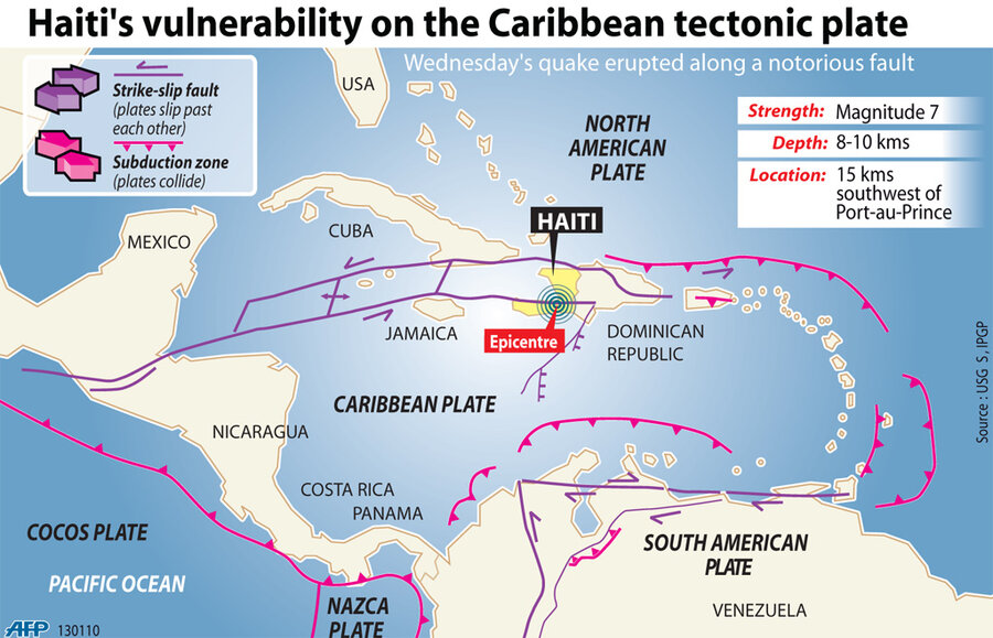
Still, scientists have pulled together an increasingly clear picture of the broad geophysical context in which Monday's event took place. Hispaniola sits squarely atop a boundary between two plates in Earth's crust: the North American Plate and the Caribbean Plate. The Caribbean Plate is trying to slide past a particularly tough block of crust underlying the Bahamas. The two are grinding past each other, much like the motion along another plate boundary -- California's San Andreas Fault.
Tuesday's quake occurred along the Enriquilla-Plantain Garden Fault, an east-west crack in the Earth that also runs west through Jamaica and out to the Cayman Islands. But Hispaniola also is home to another major fault, which cuts across its northern interior and heads toward Cuba.
These two fault systems trace their origins to a broader interaction between the North American plate and the Caribbean Plate. The North American plate is plunging under the Caribbean plate north of Hispanola and Puerto Rico. But one portion of the North America plate dubbed the Bahamas Platform is too bouyant to make the plunge easily, reseachers say. The result: The giant collision is deforming Hispanola.
Over millions of years, Hispaniola's northern fault, the Septentrional, has been the major pathway for building and releasing strain from the sideways motion of the two plates. But some researchers now argue that activity may be shifting; the Enriquilla-Plantain Garden Fault may slowly be taking over as the main strain-relief valve for the plate boundary, explains Uri ten Brink, a geophysicist with the US Geological Survey's office in Woods Hole, Mass.
In effect, the region has two parallel plate boundaries. "That's quite unusual," he says. Indeed, given the number of people who live on the island, as well as the number who visit, "this was really a wake-up call to me to try and understand this system."


