Taiwan braces for Nepartak. Are typhoons getting worse?
Loading...
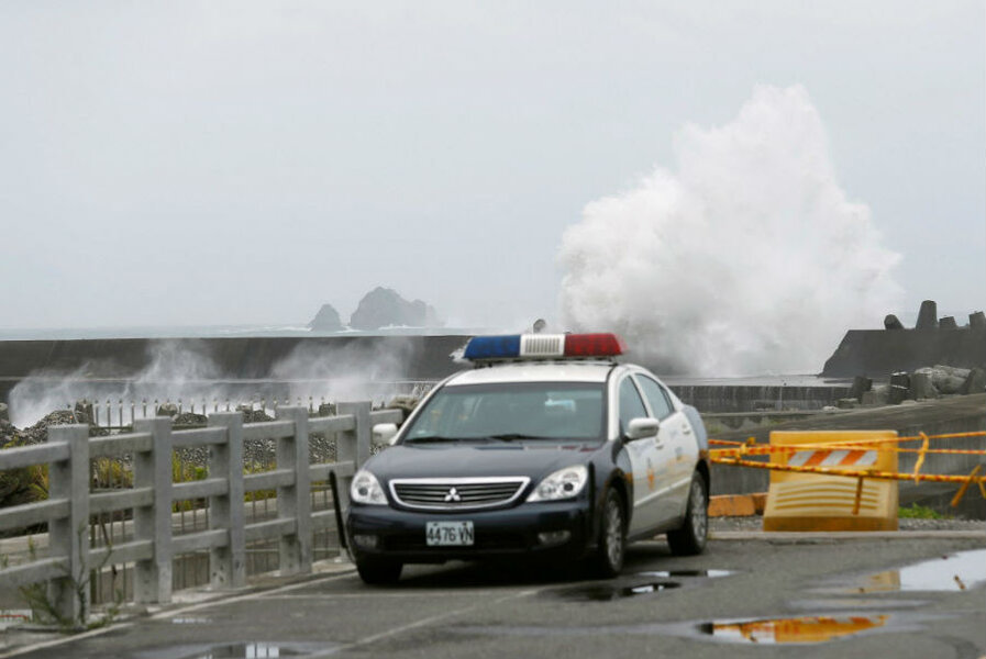
Super typhoon Nepartak, the first typhoon of the year, is speeding toward Taiwan and expected to make landfall on the country’s east coast in the early hours of Friday.
The storm, rated a 5 – the highest on the Tropical Storm Risk scale – has the potential to be the strongest typhoon to hit land in Taiwan's 45 years of reliable typhoon records. As Nepartak's center moves closer to the island and rains and winds hit the coast, recent reports gauge its sustained wind speed at 165 m.p.h., with 200-mile-per-hour winds at its center.
Some 35,000 troops have been mobilized for rescue and flood response in Taiwan, as nearly three feet of rain could inundate parts of the island. More than 100 flights have already been cancelled, USA Today reports.
The storm is expected to hit the less populated eastern side of Taiwan first and then sweep across the southern half of the country over to southern China. While the winds will continue to diminish as the typhoon meets the mainland, Nepartak is arriving after a week of widespread and fatal flooding in south and central China.
China’s Xinhua news agency said that the typhoon rains will likely worsen flooding around Wuhan, which lies on the Yangtze River and has already lost power and had flooded subway lines, Reuters reports. One-hundred thirty people have already died this week due to flooding in China, along with the loss of 1.9 million hectares of crops.
Typhoons are common in this season in the South China Sea, although Nepartak ended an all-time record storm drought in the usually highly active northwest Pacific Ocean, Colorado State University hurricane expert Phil Klotzbach told USA Today.
The 200-day absence of storms in the region may correlate with a growing body of research that suggests that warmer temperatures tend to lower the frequency of cyclones, but increase their intensity.
While the three most powerful typhoons on record occurred between 1958 and 1961, researchers say that the trend is toward stronger typhoons and that this increase is related to rising ocean temperatures.
“A warmer sea surface generally provides more energy for storm development and thus favors more intense typhoons,” said Wei Mei of the Scripps Institute of Oceanography, who led a 2015 study showing that warming ocean temperatures have caused tropical cyclones in the northwestern Pacific to strengthen about 10 percent since the 1970s. The team found that differences in temperature between the surface and subsurface of the ocean also played an important role, Smithsonian Magazine says.
While the study points to other factors, such as El Niño conditions that also impact the storm, Dr. Mei’s team found that if greenhouse gas emissions are cut and the Earth warms only moderately, the average typhoon strength will still increase an additional 14 percent by 2100.
Without reduction in emissions, “we anticipate that the typhoons will intensify even more,” Mei said, as quoted in Smithsonian Magazine.
A 2013 study by MIT professor Kerry Emmanuel points to the North Pacific, where Haiyan struck in 2013 and where Nepartak is currently moving, as the region that will see the most intense cyclones. Haiyan ravaged the Philippines in 2013 and cost that nation 6,340 lives. Typhoon Morakot in 2009 left about 700 people dead and $3 billion in damage in Taiwan.
In the wake of Haiyan, Myles Allen at the University of Oxford told The Guardian that seasonal weather forecast tools should be dedicated to looking at the influence of climate change on severe weather patterns.
"It's first things first: we should know now how climate change is affecting us rather than how it will affect us in 100 years' time,” he said in 2013. “It is a common misconception that climate change affects everyone. It affects some people a lot and others not very much – but we don't know who is who."
Material from Reuters was used in this report.


