In Pacific Northwest, a welcome break from a very wet week
Loading...
| Ashland, Ore.
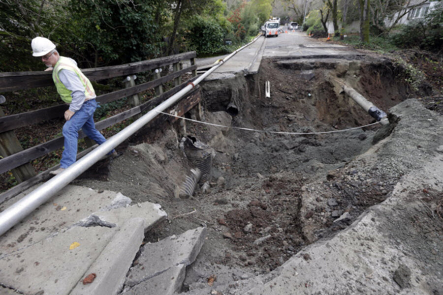
The early winter storms that soaked northern California, Oregon, and Washington over the past week are expected to taper off Wednesday evening. That’s welcome news to areas across the region that have seen swollen rivers and saturated ground with some local flooding.
Still, forecasters emphasize that winter weather advisories remain in effect for the Cascade Mountains in Washington and the Sierra Nevadas in California, and flood watches continue for western Washington and Oregon as well as northern California.
“After almost a week of heavy rain, the West will finally get a break from the deluge as this last Pacific frontal system has now pushed far enough inland in the northern Rockies,” the National Weather Service’s Hydrometeorological Prediction Center reported Wednesday morning. “The exception to this is northern California, where moderate rain is still possible as the southern portion of this system pushes through.”
The possibility of landslides remains a concern in some areas, particularly in steep mountainous areas. US Forest Service crews have been repairing small slides, removing downed trees, and unplugging culverts along unpaved roads used for logging, fire-fighting, and recreation.
“Rain over the past week has increased soil moisture to high levels across western Washington,” reports the National Weather Service in Seattle. “Cumulative rainfall has soaked soils to the point where western Washington landslide risk level is moderate…. Areas most susceptible for landslides are steep coastal bluffs and other steep hillsides.”
In southern Oregon, the Coquille River has exceeded its flood stage, bringing minor flooding of farmland and other low-lying areas. Oregon’s Umpqua, Illinois, and Rogue Rivers remain under flood watch as well.
Meanwhile, northern California is expecting another inch of rain, with coastal mountains seeing as much as six inches of precipitation before the storm moves out by Thursday.
Before this tail end of the storm system, some areas had seen as much as 15-20 inches of rain since Nov. 27. The storm on Sunday dropped as much as an inch of rain an hour in some areas while toppling trees, causing flash flooding to roadways, and knocking out power, according to the Associated Press
Still, forecasters said larger rivers in the region were expected to remain below flood stage, and the high winds that accompanied the storms had abated.
"The winds will be much lighter than over the weekend. The rainfall amounts will also be lower," National Weather Service meteorologist Holly Osbourne told the AP.
The warm rains and winds that lashed the West this past week – delivered via a narrow vigorous band of supersaturated air sometimes called an "atmospheric river" or, when such a river originates in the vacinity of the Hawaiian Islands, the “Pineapple Express” – came just as the National Oceanic and Atmospheric Administration (NOAA) was announcing a new monitoring system to forecast and assess such storms.
“The new network of sensors actually includes about 100 sites, three-quarters of which are already installed,” reports Dave Levitan of OurAmazingPlanet.com. “These include soil moisture sensors – to help forecast whether or not the ground will be able to accept more water when a storm arrives – and sensors that measure total water vapor in the air, along with the four new radar systems that will be placed along the coast to monitor for atmospheric river conditions.”
"It turns out that atmospheric rivers are the cause of most of the floods in the Western coastal states, much like we've seen just in the last few days," said F. Martin Ralph, of the NOAA Earth System Research Laboratory, at a news conference Monday announcing the installation.
As usual, weather patterns such as this most recent one in the Pacific Northwest keep moving (in this case, into the Rockies), to be followed by new ones.
“The northern part of this front is expected to race across the northern plains and into the Great Lakes while the southern portion slows and gets held up by terrain,” the National Weather Service reports. “Some more rain and high elevation snow could develop across the northwest ahead of another Pacific short wave.”


