Record drought and blazes? The US Northeast awakens to new wildfire risks.
Loading...
| Great Barrington and Sheffield, Mass.
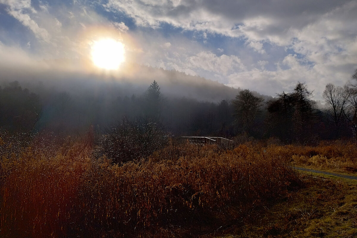
Recently, wildfire haze from the Butternut Fire obscured the ridgeline of nearby East Mountain, where just days before Black Hawk helicopters dumped water they had collected from local ponds.
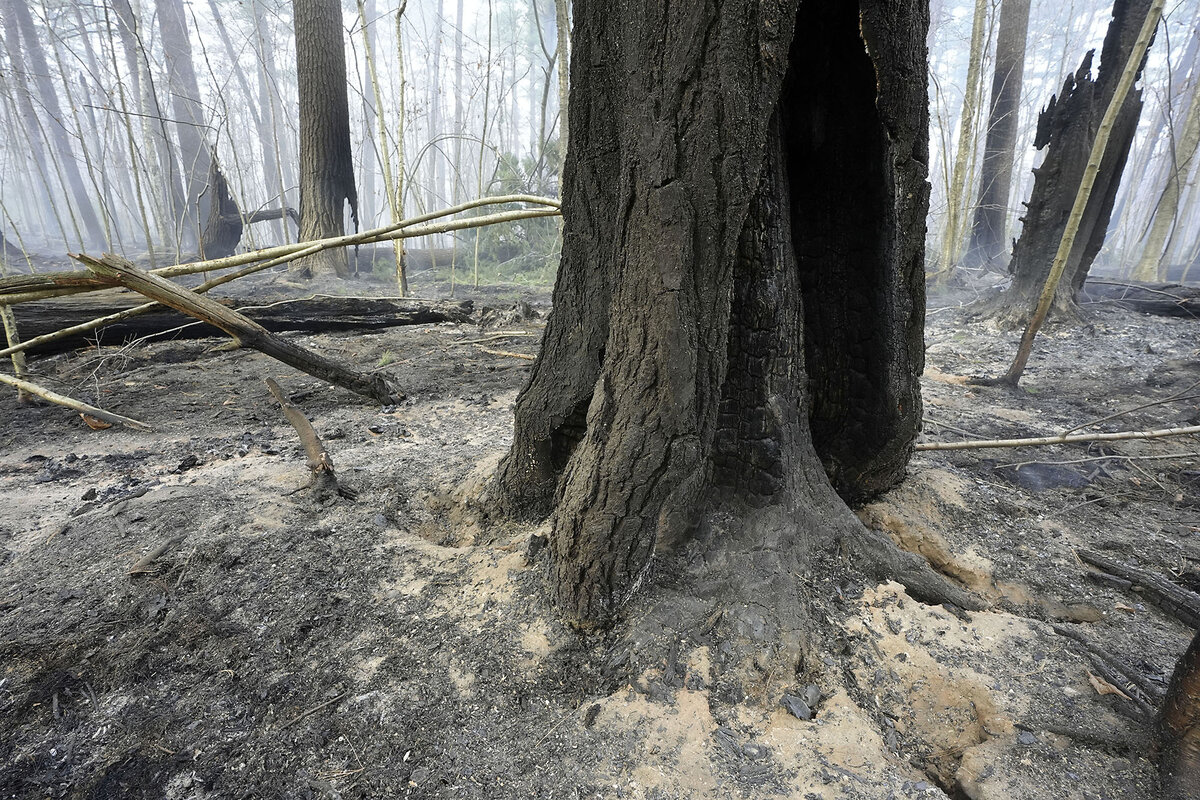
The Butternut Fire that broke out on Nov. 18 consumed over 1,400 acres of East Mountain State Forest, as well as local portions of the Appalachian Trail. The fire quickly became Massachusetts’ largest wildfire this year after months of record drought in the Northeast. It took nearly a week for a crew of local volunteer firefighters, state emergency services, and wildfire fighting crews from as far as Wyoming to contain the blaze.
Why We Wrote This
A story focused onForests make up a high percentage of the U.S. Northeast. After a record drought this fall, and increased wildfires, people in this region are recognizing the need to prepare for threats to forests.
With a decreasing winter snowpack, which leaves tree roots more vulnerable to cold, plus a new wave of forest pests that have migrated with warmer temperatures, the Northeast has unusually high levels of dead wood in its forest, experts here say. When that combines with a drought, the risk of wildfire shoots up.
But the people who live in and around the trees here are not used to thinking about forest fires. Now, forestry professionals and firefighters across New England are trying to change that.
The trail at Thomas & Palmer Brook in Great Barrington, Massachusetts, winds through mature pasture, wetlands, and forest.
Residents love this trail because of its wet coolness in the summer; its bright orange sugar maples in autumn, the contrast of green pines and white snow in the winter. But on a recent Monday, wildfire haze from the Butternut Fire obscured the ridgeline of nearby East Mountain, where just days before Black Hawk helicopters dumped water they had collected from local ponds.
Doug Brown, director of stewardship at the Berkshire Natural Resources Council, a nonprofit that maintains nearly 14,000 acres of wild land and over 60 miles of trails in this western Massachusetts county, stares into the distant haze, shielding his eyes from the sun.
Why We Wrote This
A story focused onForests make up a high percentage of the U.S. Northeast. After a record drought this fall, and increased wildfires, people in this region are recognizing the need to prepare for threats to forests.
“Climate vulnerabilities show up in a lot of different ways in our community,” he says. “But we weren’t thinking a lot about fire.”
The Butternut Fire that broke out on Nov. 18 consumed portions of the Appalachian Trail, as well as over 1,400 acres in East Mountain State Forest, here in Great Barrington and nearby Sheffield. The fire quickly became Massachusetts’ largest wildfire this year after months of record drought in the Northeast. It took nearly a week for a crew of local volunteer firefighters, state emergency services, and wildfire fighting crews from as far as Wyoming to contain the blaze.
“It’s not something I’ve seen out here before,” says Mr. Brown. “I’ve been through areas under wildfire in the western U.S., and I’ve been in those smoky contexts, but I’ve never seen a plume of fire come over the hillside” in Massachusetts.
The Butternut Fire finally fizzled out on Dec. 1. No lives or structures were lost in the blaze. Firefighters and local police are currently investigating the cause of the fire, but suspect that humans were the source.
In October alone, wildfires across Massachusetts increased by 1,200% over the state’s annual October average of 15 wildland fires.
“We can tell you that we’ve had no thunderstorm development in the month of October and November, which means there’s been no natural-caused fires,” Massachusetts State Fire Supervisor David Celino says. “So all of the fire activity we’ve seen is human caused in some form or fashion.”
And that, he and other forestry professionals and firefighters say, is a new challenge for this forested region.
With a decreasing winter snowpack, which leaves tree roots more vulnerable to cold, plus a new wave of forest pests that have migrated with warmer temperatures, the Northeast has unusually high levels of dead wood in its forest, experts here say. When that combines with a drought – like this year’s driest fall in at least 120 years for portions of the region – the risk of wildfire shoots up.
But the people who live in and around the trees here are not used to thinking about forest fires. Now Mr. Celino, along with other forestry professionals and firefighters across New England, are trying to change that.
Wildfire lessons for the Northeast
The Northeast is one of the most densely forested regions in the U.S., with 170 million acres of forestland cover and tree canopy and other green spaces covering 35% of urban areas in the region. The region isn’t yet facing wildfires on the scale of those on the West Coast, where burns can engulf entire towns. But wildfire preparedness is generally lacking, most experts here agree.
In Connecticut, for instance, there were 200 fires this past fall.
“Those oak trees ... were lighting up like matchsticks,” says Andy Bicking, executive director of the Connecticut Forest & Park Association.
In a recent research paper for the National Fire Academy, Christopher Renshaw, interim fire chief at the University of Connecticut, found that overall wildfire preparedness in Connecticut – from fire policy to public education on wildfires – is behind the rapid changes the state’s forests are facing.
Yet there are models elsewhere in the country for Northeastern firefighters to study, Mr. Renshaw says. In his paper, he highlighted the 2023 wildfires on Maui as a preview of potential threats to Connecticut’s forests.
“A large, vast percentage of our country [is] already dealing with this problem,” he says. “So we don’t have to go far for lessons learned.”
Innovative ideas
Indeed, some unique wildfire management efforts are already taking shape in the Northeast.
Elia Del Molino says he could see the Butternut Fire and smell its smoke from April Hill, the home of Greenagers, a nonprofit where he works as conservation director. The organization employs youth to maintain and clear trails alongside local environmental groups like the Berkshire Natural Resources Council. Not long ago, they didn’t even have wildfires on their radar. Now, Greenagers is creating training programs for members to get certification for fighting blazes in their forests.
“When we build trails, pretty much the first step is you dig the fire line,” says Mr. Del Molino.
Young people are also addressing the strains put on local fire departments. Despite declining numbers in recent decades, some volunteer firefighter departments have seen an uptick in younger people hoping to help save their forests.
The Williamstown Fire Department, for instance, located in northern Berkshire County, has seen an increase of eager part-time volunteers over the past few years among students attending Williams College.
Further south, on a 600-acre plot in the New Jersey Pine Barrens, one of the largest wilderness areas on the East Coast, forestry professionals study prescribed fire, wildfire effects, and fire tools at the Silas Little Experimental Forest. According to Dr. Michael Gallagher, a research ecologist with the U.S. Forest Service Northern Research Station and the lead scientist at the experimental forest, his team has received more questions recently from forestry management professionals and firefighters about monitoring and managing wildfires.
“We will go out and participate in prescribed burning or wildfire operations to support local agencies,” Dr. Gallagher says. All of the technicians at the experimental forest are “red carded,” meaning they’re all qualified wildland firefighters. “Through those experiences, we also get a very good sense of what managers need and how to respond to them.”
The team at Silas Little Experimental Forest has been focusing a lot on terrestrial laser scanning, or terrestrial lidar. The device is a laser range finder built so that it can pivot on a tripod and scan the whole forest. “We use that to collect very rich structural data about the forest,” Dr. Gallagher explains. “That data can help describe the state of the forest, whether there’s a major fuel hazard there or the hazard’s been mitigated through some type of management, maybe prescribed fire or mechanical thinning.”
He describes it as a device that is easy to learn to use because it has one button, does the work itself, and only takes about 30 seconds to collect the scan. Lidar can also track forestry changes over time, even in the midst of multiple wildfires. “If you do a treatment where a wildfire comes through, you can continue to go back and use this monitoring tool through time as the forest changes after that,” Dr. Gallagher says.
Forests in the New Jersey Pine Barrens, and even the majority of the East Coast, are fire-adapted and even fire-dependent. Prescribed burning, Dr. Gallagher says, is a proactive approach to reducing wildfires. Maintaining the forests with these burns can help them grow and flourish. “Fire is a natural process and a necessary process to keep these assemblages of species going.”
As for East Mountain State Forest, Mr. Brown says, it will be fine.
“The trees that remain – the oak trees in particular – they’re going to do really well,” he says. “They’re resilient against fire, and hopefully this clears the way for better forest regeneration and less invasive species coming in.”
Editor’s note: This story, originally published on Dec. 6, has been updated to correct the name of Thomas & Palmer Brook.


